Investigating WWII History
THE DAU AIRFIELD: A FORGOTTEN AIRSTRIP OF THE CLARK AIR DISTRICT OF WWII
ダウ飛行場: 大東亜戦争時のクラーク飛行場における、忘れ去られた飛行場
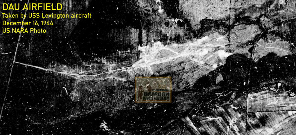
One of the newly constructed satellite airfields of Clark, Dau Airfield was located about 3 kilometers directly to the east, on what is now the vicinity of Pulung Cacutud. Dau Airfield was part of the Clark Air Center, located east of the Clark Proper. The airfield is closed to the barrio of Pulung Cacutud than in Dau, which was by 1944, a former artillery training center for the Philippine Army and later became the main Japanese hospital facility and an important train station and junction. Probably, the military importance of Dau became the basis to name the airfield by the Americans as Dau Airfield, although, this author did not find any Japanese source or reference to this specific airfield.
US NARA Photo.
LOCATION OF DAU AIRFIELD ダウ飛行場の所在地
Visual estimation and critical analysis of air strips of Clark based on Sketch Map of Clark Field and Dau Airfield can provide an approximate length of 770 x 60 meters (approximately 2,526 x 196 feet) on east-west air strip direction and was partially completed small airfield. The coverage of this stretch of the airfield is now located starting from the Iglesia Ni Cristo (INC) Chapel in Pulung Cacutud, Angeles City, and 770 feet to the left (west); crossing the Magalang-Angeles Bypass Road, continuing further on the left on the open spaces (north of the Pampanga Economic Zone Philippines) and then crossing the North Luzon Expressway (NLEX) until about a 100 meters (328 feet) immediate to the left. 1
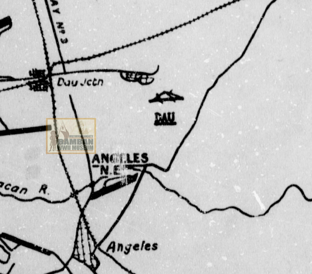
Vicinity December 16, 1944″, US NARA.
ROAD NETWORK AROUND AIRFIELD ダウ飛行場につながる道路
To determine the road networks connected to Dau Airfield, the author made comparative analysis of the Sketch Map of Clark and Dau Airfields with the US Army topographical map circa 1944 and the NAMRIA topographical map circa 2007. Accordingly, there was a road network from Camp Dau which was connected to the Dau Junction after crossing the Manila-Dagupan Railroad tracks and traversed southeast, crossing the present Dau Access Road (connecting Dau Rotonda to NLEX) and then into Barangay Duquit, where another access road crossed the river and thence into the southeast direction into Barangay Pulung Cacutud in Angeles City, where the main air strip is located. From the airfield proper, another road lead to the right (east) and connected to the Angeles-Magalang Road. 2
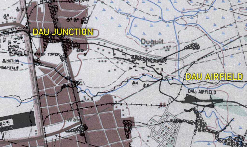
Airfield; using US Navy map “Sketch Map of Clark Field and Dau Airfield” and NAMRIA TOPO MAP “Angeles” circa 1977.
EXTENT OF AIRFIELD AND FACILITIES 飛行場および施設の範囲
The airfield had a capacity to accommodate less than a hundred aircraft and was used both by the Imperial Japanese Army and Navy Air Service. Large and small buildings (20) and probably troop barracks and repair shacks and facilities were constructed northwest of the air strip, on what is now vicinity of Baranggay Duquit. The buildings and facilities of the airfield, including troop barracks, command posts and perhaps ammunition dumps and other logistical facilities were located on what are now the stretch of lands occupying the streets of Bagong Silang, the areas of Bagong Lipunan, Ubas and Lanzones streets in Barangay Duquit, Mabalacat City. Such stretch of the land that covers the location of the building facilities of the airfield is now fronting the Dau NLEX Access Road from S & R (Dau Branch) to the facility of Deang Marketing Corporation. It is interesting to observe based on US Navy map that there were 20 building facilities near the Dau Airfield used as barracks, nipa huts, repair shacks and other air installations used primarily for airfield operations located at the village of Duquit. On December 16, 1944, more than 15 aircraft where parked on the dispersal area which were attacked by fighter sweeps from the Fighter Squadron 20 (VF-20), Air Group 20, USS Lexington. 3
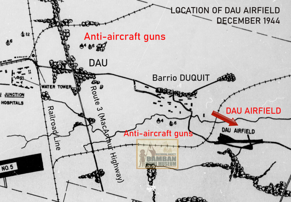
repair facilities were located. Map from “Sketch Map of Clark Field and Dau Airfield”,
US NARA.
DAU AS OPERATIONAL AIRFIELD 運用中の飛行場としてのダウ
Despite being partially completed air strip, by December 1944, Dau Airfield was in fact, operational airfield used both by the Imperial Japanese Navy Air Service and Imperial Japanese Army Air Service. Observations made by pilots from Air Group 20, USS Lexington during air raids in December showed that the air strip had serviceable aircraft such as Mitsubishi G4M Rikko “Betty” bomber and single-engine aircraft, probably Mitsubishi A6M Zero, Nakajima Ki-43 Hayabusa “Oscar”, Nakajima Ki-44 Shoki “Tojo” or the Kawasaki Ki-61 Hien “Tony” operating, aircraft taking off and there was semblance of air sorties. If the single-engine aircraft was the Ki-43 Hayabusa, such fighter aircraft came from the 13th Air Brigade (2nd Air Division) based at Angeles and Mabalacat airfields; the Ki-44II from the 246 Air Regiment (2nd Air Division) based at Clark Central airfields, or the Ki-61 from the 22nd Air Division mostly based at Clark and Angeles West airfields. It might be possible that the G4M Rikko “Betty” that were at Dau Airfield in December1944 might be a contingent of the Attack Hikotai 702, Air Group 763 (763 Kokutai) that was left at Clark and in the Philippines at the end of the war. 4 In the course of researching the Japanese air army and navy air force units assigned at the Dau Airfield, this author was unable to gather information on Japanese sources. Hence, it might be possible that Dau Airfield was completed later than the other airfields at the Clark District and was used after the Battle of Leyte Gulf in October 1944. Therefore, the deployment of the Mitsubishi G4M Betty “Rikko” and the single-engine fighter aircraft observed and reported by the pilots of the Air Group 20 from the USS Lexington were deployed at the said airfield later in December 1944 in an effort to dispersed the Japanese aircraft from both the 4th Air Army and the Imperial Japanese Navy’s 1st Combined Air Fleet; aside from the fact that the airfield was only found to be existing and operational during Task Force 38 carrier-borne aircraft air assault at Clark Field on December 16, 1944. 5
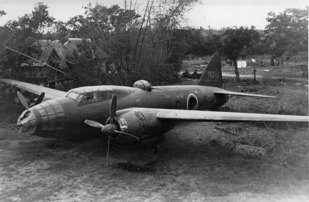
at Clark Field after the capture of the airfield in late January 1945.
ANTI-AIRCRAFT GUNS
Based on the Sketch Map of Clark and Dau Airfields which was a product of the photo reconnaissance conducted by the Air Group 20, USS Lexington in December 1944, there were 4 heavy anti-aircraft (75-mm or 120-mm guns) and 8 automatic cannons (most probably Type 96 25-mm cannons or the Type 2/98 20-mm AA machine cannon) located west of Dau Airfield, on what is now the area between Hadrian 1 and Purok 7 Outpost, Barangay Pulung Maragul in Angeles City. 6
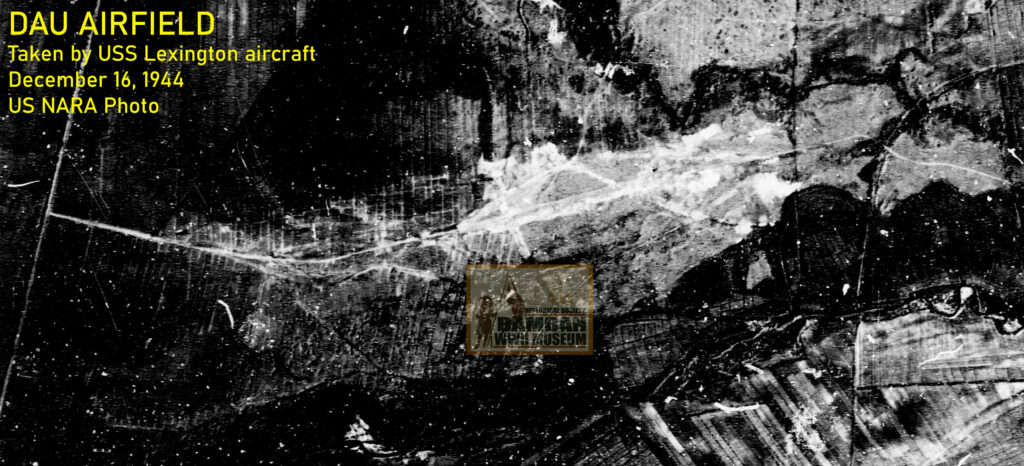
US NARA Photo.
Further to the northwest of the airstrip, approximately 2.5 kilometers, there were also 6 automatic cannon emplacements, either the Type 2 20-mm AA machine cannon (German Flak 30/38 Flakvierling 20-mm cannon) or the Type 98 20-mm AA gun and the Type 96, 25-mm (single, duel or triple mount). Scaled Sketch Map for Clark and Dau in comparative analysis with the NAMRIA topographical map and Google Map will indicate that the location of these 6 automatic cannons are at present Antipolo Street, in the vicinity of Jayem Food Hub, Barangay Dau, Mabalacat, Pampanga. The 4 heavy anti-aircraft artillery, either the Type 88, 75mm mobile field AA gun or the Type 10, 120mm dual purpose naval gun were established adjacent to the left, on what is now Mt. Makiling Street, in the vicinity of Jayem Food Hub, Barangay Dau, Mabalacat, Pampanga. 7
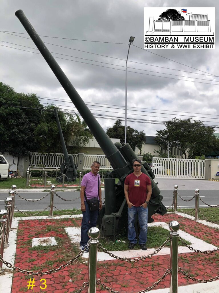
Rhonie Dela Cruz Photo.
Using the same Action Reports of USS Lexington, from which the Sketch Map for Clark and Dau Airfields was included, a lone aerial photograph was taken by Grumman F6F-3P showing the aerial image of the Dau. From this image, it has been identified that aside from the 4 heavy anti-aircraft guns and 4 automatic guns appearing on Sketch Map, there were also anti-aircraft positions about 1 kilometer to the east, on the right of the Angeles-Magalang Road. The first anti-aircraft gun position was composed of 8 gun emplacements, visual analysis concluded that the emplacement were for automatic cannon such as Type 96 25-mm, Type 2 20-mm AA machine cannon (German Flak 30/38 Flakvierling cannon), Type 93 13.2-mm machine gun or the Type. To the right, near the Angeles-Magalang Road, in the vicinity of Paddle Up! Pickleball courts, where 6 heavy anti-aircraft (ranging from Type 88 75-mm to Type 10 120-mm guns) emplacements. 8 The availability of aerial photographs provided additional details of the anti-aircraft gun emplacements not identified on USS Lexington map of Clark and Dau Airfield.
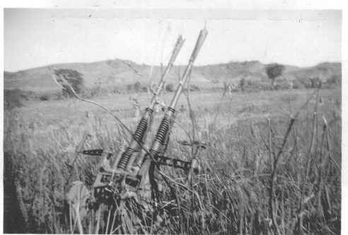
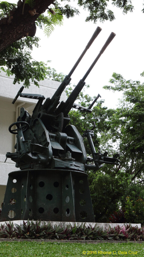
Japanese Type 96 25-mm anti-aircraft automatic cannons were also prevalence as AA guns around airfields, perhaps at the Dau Airfield. The Type 96 photograph in 1945 near Bamban (probable) on the left, while the well-preserved Type 96 dual-mount in display in front of Clark Museum.
AIR OPERATIONS OVER DAU AIRFIELD
It must have been the case that Dau Airfield, due to its size and the time frame it was used was only in the latter days of 1944, that it was overlooked by the US Navy Task Force 38 and it was not bombed or strafe in the previous air operations until December 16, 1944. At the time, it was in support of the Mindoro Operations by the US Navy that air group elements of the Task Force 38 must contain Japanese air capability by conducting attacks on Japanese air installations and aircraft at Clark District. On December 16, 1944, Air Group 20 from USS Lexington (CV-26) conducted 3 air combat missions at Dau Airfield, with Clark Nos. 4 and 5, as well as Angeles Airfield. These air combat operations were conducted with the following details:
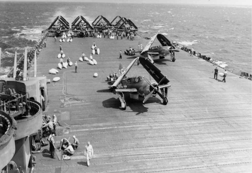
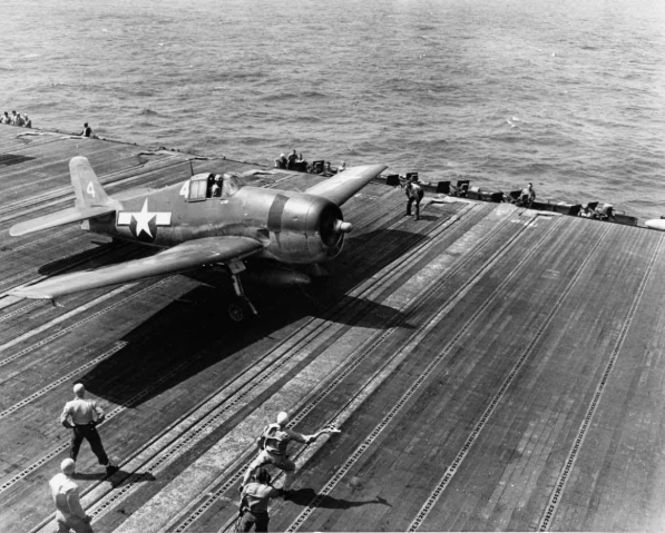
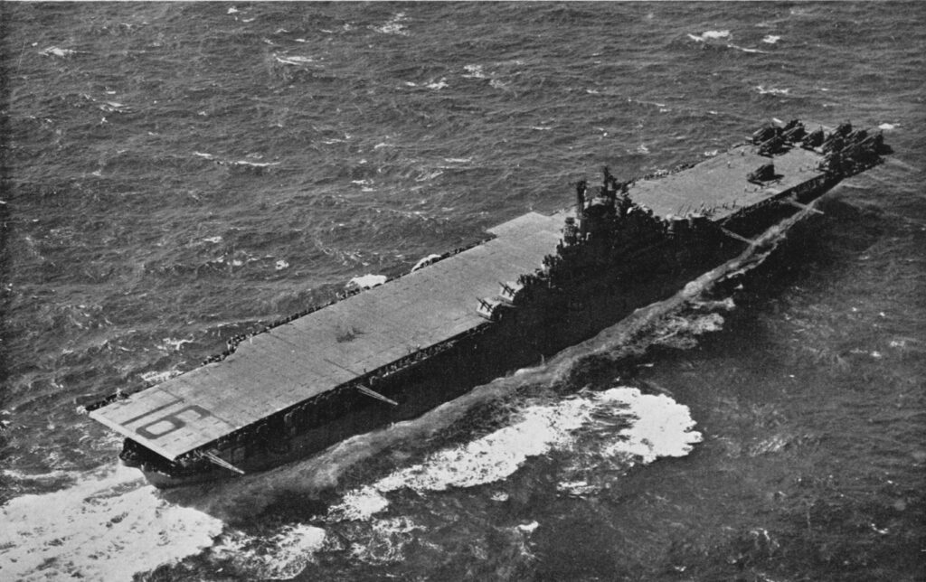
Grumman F6F-5 “Hellcat” from USS Lexington in WWII, the unit; Fighting Squadron 20 (VF-20), conducted several fighter sweeps over Dau Airfield on December 16, 1944.
AIR COMBAT OPERATIONS AGAINST JAPANESE-HELD DAU AIRFIELD, DECEMBER 16, 1944:
(1) At 0945-hours, 8 Grumman F6F-5 Hellcats conducted bombings and strafing runs (fighter sweeps) and attack on airfield installations and aircraft on the ground, the contingent of the Grumman F6F-5 was led by Commander Smith from the Fighting Squadron 20 (VF-20). Tactical air operations included bombing targets such as anti-aircraft positions (4 heavy AA guns and 8 automatic cannons) located below the village of Duquit with 500-pound general purpose bombs (AN-M64 general-purpose demolition bomb). The Grumman F6F-5 also strafed the airstrip with serviceable aircraft, damaging a parked Mitsubishi G4M Rikko “Betty” bomber and a single-engine fighter. An aircraft repair facility with a single engine fighter located nearby this shack was attacked by the Grumman. 9
(2) At 1400 hours, 5 Grumman F6F-5 Hellcats from Fighter Squadron Twenty (VF-20) conducted fighter sweeps on the airstrip and on the anti-aircraft positions west of the airfield, dropping 2 500-pound bombs, firing 12 rockets and 2,500 rounds of .50 caliber on the targets. Three (2) single-engine aircraft were hit on the ground and the 500-pound bombs made direct hits on the heavy anti-aircraft guns and automatic cannons west of the airfield. During the fighter sweeps, there were no Japanese air interceptions made while the anti-aircraft fire was from machine gun as moderate, from 20-mm (medium AA), as meager, and moderate fire from heavy anti-aircraft guns. 10
(3) At 1545 hours, 8 Grumman F6F-5 Hellcats from Fighter Squadron Twenty (VF-20) conducted fighter sweeps on parked 10 to 15 aircraft on the dispersal area along the north edge of the runway. Four (4) of the Grumman F6F-5 Hellcats were armed with AN-M64 general-purpose aerial bombs, hitting a single-engine Japanese fighter while the other 4 Hellcats were armed with 5-inch high velocity aircraft rockets (HVARs) and strafing the remaining Japanese parked aircraft, destroying 1 aircraft. Japanese gunners of automatic anti-aircraft guns fired on the marauding Hellcats with intensity while machine gun fire were encountered with meager intensity. 11
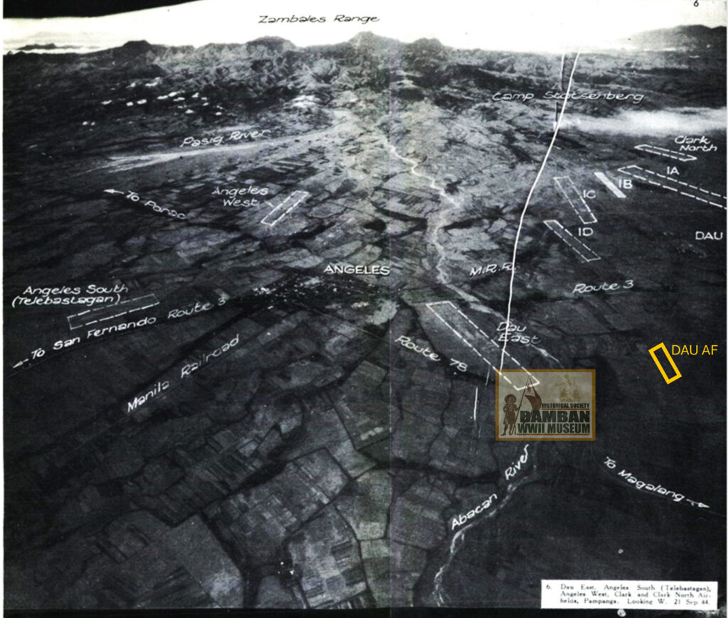
Angeles Airfields. Dau Airfield is marked (yellow) to show its location, image dated September 21, 1944.
Source: Terrain Study No,. 94
FILIPINO GUERRILLAS OPERATING IN DAU
Dau Airfield, in the town of Mabalacat, the latter being located northwest of the Pampanga Province, was therefore under the sphere of command of Captain Henry Clay Conner of the USAFFE Squadron 155, Luzon Guerrilla Forces (LGF). In the sphere of Captain Conner’s command, the barrio of Dau and the Dau Airfield were located on the east sector. Local guerrillas from the Squadron 155, like the Angeles Intelligence Unit under the command of 1st Lieutenant Marino Valdes, which was based nearest the airfield, may have taken sketches of the airfield and provided them to the headquarters of 155 for dissemination to higher command echelons in the Luzon Guerrilla Forces. Captain Conner made reports about the Dau to the headquarters of Luzon Guerrilla Forces before the advance of the 37th Division in January 1945,while a map was prepared by him showing the extent of sphere of the Squadron 155 and its headquarters’ movement west of Clark-Fort Stotsenburg. 12
Dau area in guerrilla sector during WWII.
Source: Malcolm Decker, On a Mountainside – The 155 Provisional Guerrilla Battalion
Against the Japanese on Luzon.
At the start of the Air War over Clark Field on September 21, 1944, Captain Conner was already monitoring the situation as to the fate of downed American aviators shot down either in dog fight with Japanese fighters or by anti-aircraft fire, including the area of Dau Airfield in Mabalacat. At the time, Squadron 3, Villamor Battalion, 3rd Regional Command of the HUKBALAHAP led by Commander Paul Aquino, was also operating in the area; the two forces where in cooperation in saving lives of American downed pilots. 13
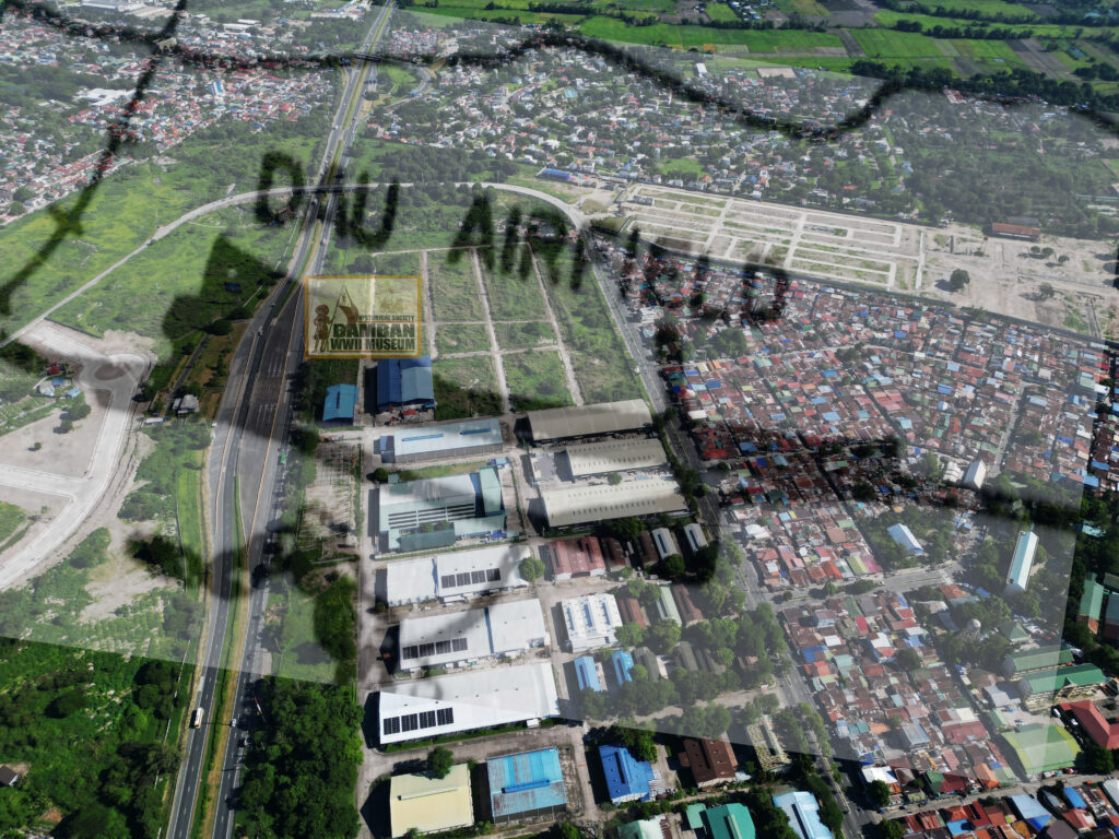
recently to show the approximate location.
Today, Dau Airfield lay forgotten in the memory of the people, more than 80 years since the war ended. The veterans, especially the local guerrillas who may have knowledge of the Dau Airfield, has long gone. The generations of WWII who were in their youth at the time, are now in their late 90s and are rarity in the local populace. This writing is an attempt to put Dau Airfield into historical literature, so that history will never be forgotten.
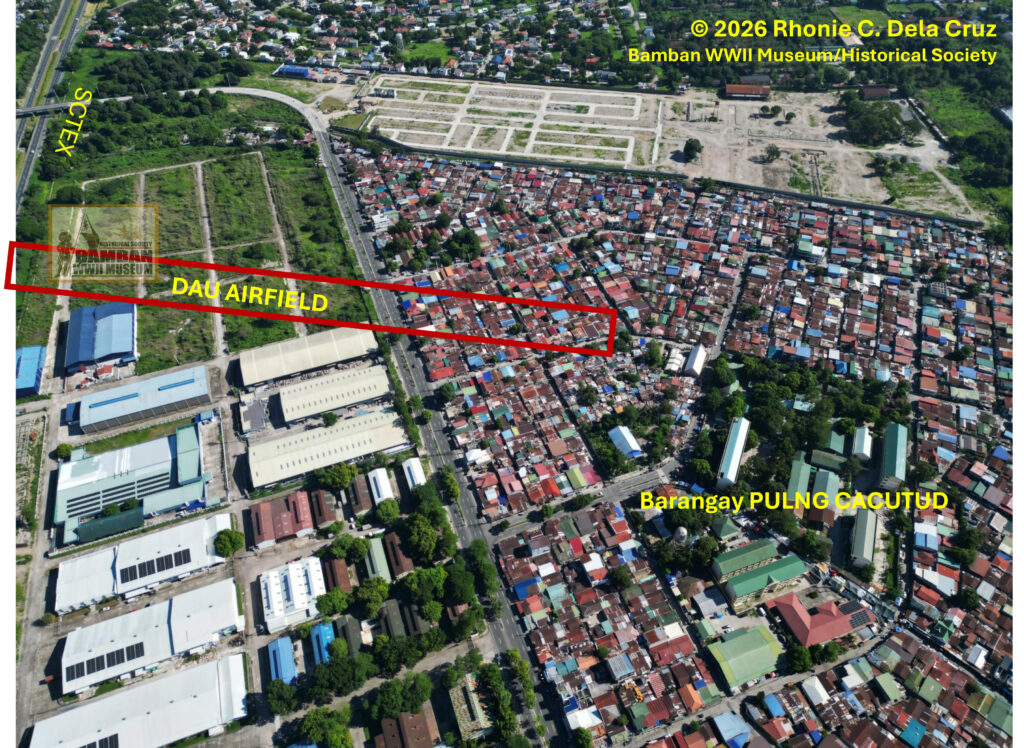
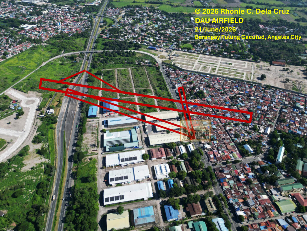

Aerial photographs taken by DJI drone of the former Dau Airfields, identified to be located at Pulung Cacutud, Angeles City. All photographs by Rhonie Dela Cruz.
© 2026 Rhonie C. Dela Cruz
Bamban WWII Museum/Historical Society
Bamban Center for Pacific War Studies
WWII Remembrance Network – Hell Ships Memorial Foundation
PGT – Tarlac Provincial Tourism Office
Bamban Tourism
END NOTES
1 Including preceding sentence, see Sketch Map for Clark Field and Dau Airfield “USS Lexington – Attacks on Luzon on 14, 15 and 16 December 1944, Report No. CV16/A16-3, Serial 0423”; Sketch No. 13 – Bamban Fort Stotsenburg, 24-January-1945 to 21-February-1945, Magalang 1944 3256 I; in order to identify the location of the Dau Airfield facilities and runway, the author utilized Google Earth and Google Map and had made comparative and critical comparison with the scaled map of Clark and Dau Airfields circa 1944, see Google Earth – Clark International Airport, June 1, 2026, https://earth.google.com/web; Google Maps – Clark International Airport, June 14, 2026, https://www.google.com/maps.
2 Sketch Map for Clark Field and Dau Airfield “USS Lexington – Attacks on Luzon on 14, 15 and 16 December 1944, Report No. CV16/A16-3, Serial 0423”; Sketch No. 13 – Bamban Fort Stotsenburg, 24-January-1945 to 21-February-1945, Magalang 1944 3256 I; Angeles City Sheet No. 3131-III; Google Maps – Clark International Airport, June 14, 2026, https://www.google.com/maps.
3 Including preceding sentence, see Sketch Map for Clark Field and Dau Airfield “USS Lexington – Attacks on Luzon on 14, 15 and 16 December 1944, Report No. CV16/A16-3, Serial 0423”; Angeles City Sheet No. 3131-III; Google Maps – Clark International Airport, June 14, 2026, https://www.google.com/maps.
4 “After Action Report – Air Group 20, USS Lexington Report No. AG-20 #143, December 16, 1944”; on the Mitsubishi G4M Rikko “Betty” bomber at Dau Airfield, see Osamu Tagaya, 90, 101-102; “After Action Report – Air Group 20, USS Lexington Report No. AG-20 #145, December 16, 1944”, National Archives and Records Administration NARA, College Park, Maryland; “After Action Report – Air Group 20, USS Lexington Report No. AG-20 #146, December 16, 1944”, National Archives and Records Administration NARA, College Park, Maryland.
5 “After Action Report – Air Group 20 USS Lexington, Report No. AG-20 #143, December 16, 1944”, National Archives and Records Administration NARA, College Park, Maryland; the Dau Airfield was discovered to be a new operational airfield east of the Clark Proper airfields and Dau Junction by the pilots from the Air Group 20, USS Lexington, see “After Action Report – Air Group 20, USS Lexington Report No. AG-20 #146, December 16, 1944”, National Archives and Records Administration NARA, College Park, Maryland.
6 Including preceding sentence, see Sketch Map for Clark Field and Dau Airfield “USS Lexington – Attacks on Luzon on 14, 15 and 16 December 1944, Report No. CV16/A16-3, Serial 0423”; Sketch No. 13 – Bamban Fort Stotsenburg, 24-January-1945 to 21-February-1945, Magalang 1944 3256 I; “After Action Report – Air Group 20, USS Lexington Report No. AG-20 #143, December 16, 1944”, National Archives and Records Administration NARA, College Park, Maryland.
7 Including preceding sentence, see Sketch Map for Clark Field and Dau Airfield “USS Lexington – Attacks on Luzon on 14, 15 and 16 December 1944, Report No. CV16/A16-3, Serial 0423”; Sketch No. 13 – Bamban Fort Stotsenburg, 24-January-1945 to 21-February-1945, Magalang 1944 3256 I; Google Maps – Clark International Airport, June 14, 2026, https://www.google.com/maps.
8 “File No. CV16/A16-3 Serial 0423 – U.S.S. Lexington”; New Strip Near Dau Junction, photograph “File No. CV16/A16-3 Serial 0423 – U.S.S. Lexington”, National Archives and Records Administration NARA, College Park, Maryland; the author used Google Earth for the approximate location of the additional gun positions from the airfield, see Google Earth, June 1, 2026, https://earth.google.com/web.
9 After Action Report No. AG-20/#143 USS Lexington, December 16, 1944, National Archives and Records Administration NARA, College Park, Maryland.
10 After Action Report No. AG-20/#145 USS Lexington, December 16, 1944, National Archives and Records Administration NARA, College Park, Maryland.
11 After Action Report No. AG-20/#146 USS Lexington, December 16, 1944, National Archives and Records Administration NARA, College Park, Maryland.
12 Squadron 155, Luzon Guerrilla Forces “USAFFE Guerrilla Forces HQ 155 Fort Stotsenburg, Pampanga”, “Conner to Col. G. Merrill, January 147, 1944” (LGF) [folders 1-2], (Box 489, File 286-13), NARA; Malcolm Decker, 180.
13 Malcolm Decker, On a Mountainside: The 155th Provisional Battalion Against the Japanese on Luzon “Conner to Colonel G. Merrill, September 30, 1944”, 176.