
From Naval Air Force to Mountain Soldiers: The 763 Naval Air Group
海軍航空隊の兵士: 第763海軍航空隊
Under the heat of the sun, some men braved the hot weather condition and hiked the mountain overlooking the Sacobia River in search for the Japanese WWI tunnels. With the help of our Aeta Mag Antsi mountain scouts, we were able to locate the tunnels midway Haduan and Calang.

During WWII, the area was the edge of the 16th Naval Combat Sector, Kembu Group composite division, under Captain Naodai Sata. Captain Sata was the commander of the 763 Kaigun Kokutai (763 Naval Air Group 第七六三海軍航空隊), the unit was famous for its Mitsubishi G4M (Navy Type 1 attack bomber), with Allied name “Betty” bomber that was based at Clark Airfields starting in late October 1944.

Most of these Rikko “Betty” bombers from K703, K708 and K702 squadrons, 762 Air Group were expended in air operations in Leyte. With the failure of the Sho-Ichi Go Operations, the K7036 and K718 bomber squadrons retreated to Japan, and lastly, the serviceable Rikko “Betty” K702 escaped but the ground personnel and other officers of the 763 Air Group, including its commanding officer, Captain Sata, remained and deployed in the hills of Haduan area to fight as auxiliary infantry of the 16th Naval Combat Sector behind Clark Field and overlooking the Sacobia River with a strength of 6,000 men (data from Ministry of Health and Welfare), mostly naval personnel from the 763 and other units from 405 Sento Hikotai (Fighter Squadron) and elements from the 153 Kokutai and 308th Pioneer Naval Construction Unit.
Captain Sata Mountain Fortress: Red Mountain and Mountain of Mines
赤山と甲山の陸軍大尉佐田。
On the record of the Kembu Group written in Japanese, the Japanese military identified the hill south of Haduan as “Kouzan”; literally a mountain or “a place where minerals are extracted from the ground, such as coal, diamonds or gold”. Is it perhaps Kouzan Mountain, as the Japanese military at the Kembu Group had given such a name that such precious stones was found and extracted in that place? Haduan Mountain was called “Akayama”, or Red Mountain by the Japanese in 1945. Before the land battle that started the Bamban Hills to the north in late January 1945, the hills behind Clark Field, commonly called the Bamban, were literally interconnected with mountain trails, roads and paths, where the Japanese massive deployment of naval forces numbered about 20,000 men bringing supplies, war materiel and arsenals in the vast expanse of the rough terrain including the Kouzan at the 16th Naval Combat Sector.

The Graves of Fireflies in the Mountains
甲山の蛍の墓。
The 16th Naval Combat Sector under Captain Sata engaged the American forces from the 40th Division in late February 1945, then by the 43rd and later the 38th Division U.S. Army, aided by Filipino guerrillas including the Aeta Squadron 30. The unit was the least supplied or armed with rifles from among the naval combat sectors holed in the mountains of Bamban behind Clark. Utilizing the tunnel defenses fortified with machine guns and automatic cannons, the Japanese defenders under Captain Sata fought up to late March 1945, the main body destroyed from among the tunnels constructed and fought that only 1,300 men remained in combat condition by the time. By the end of the war, only 350 of the original 6,000 men survived.

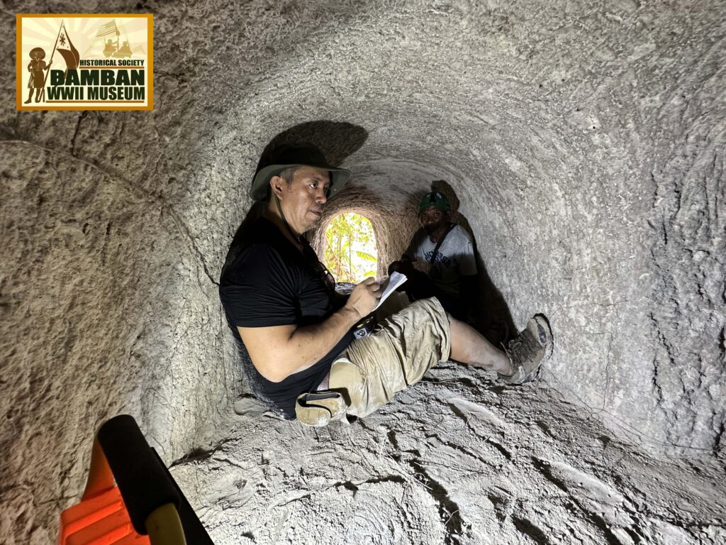
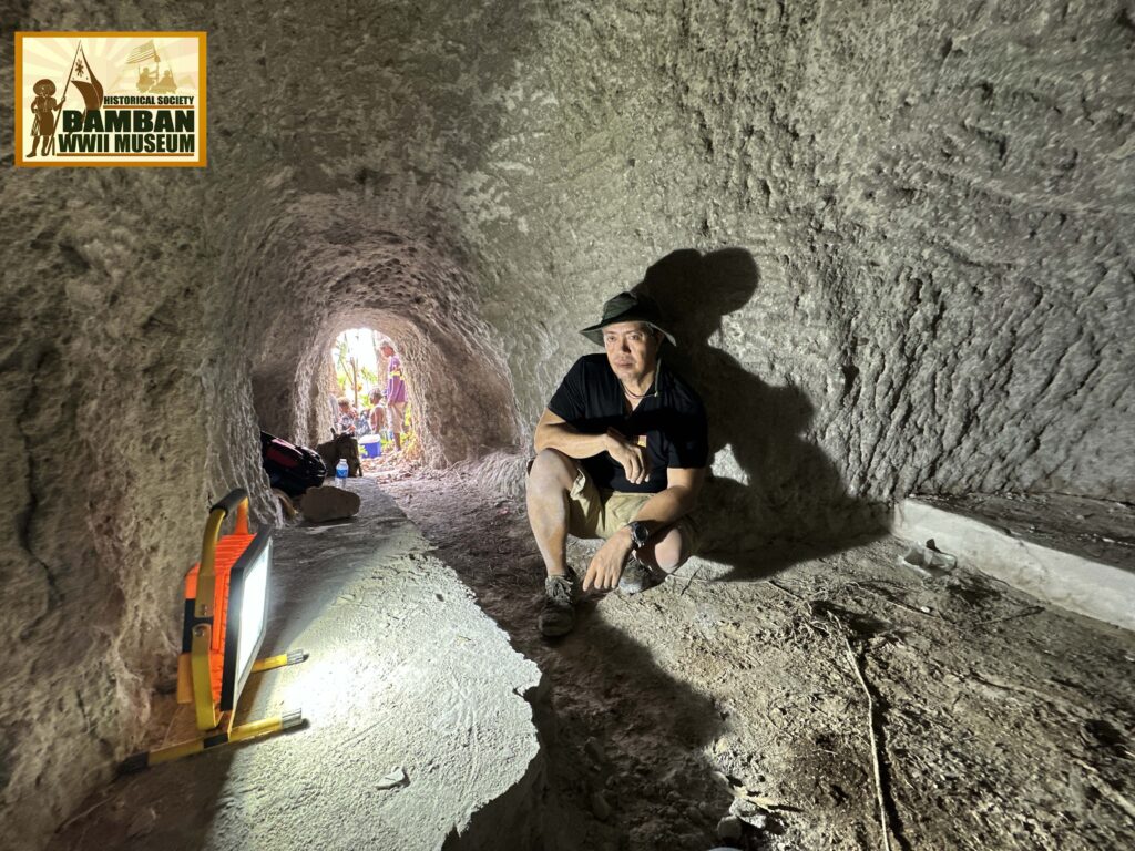
War Tunnels of Mines Mountain
香山の大東亜戦争トンネル。
Eighty years since the defeat of the Kembu Group in Bamban Hills, the Japanese tunnels are the only tangible evidence of the once bloody battlefields of the Pacific War. And only a few remained due to passage of time, erosion and human activity.
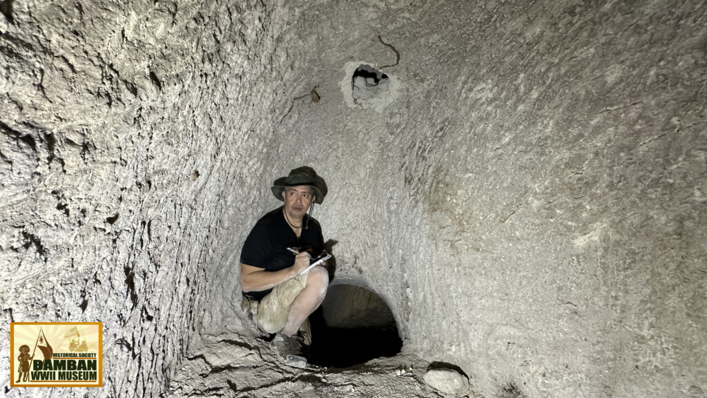
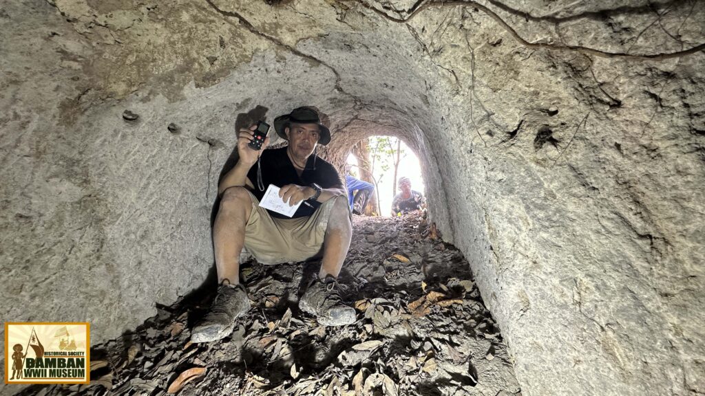
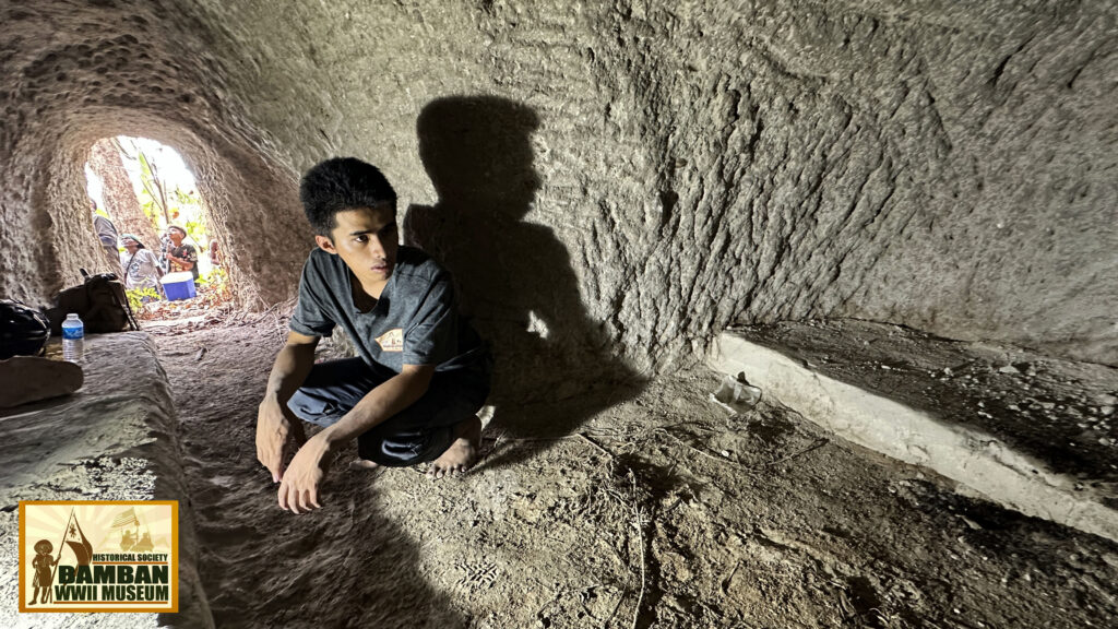
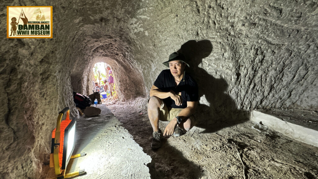
These pictures show what remains of the site of the bloodiest fights in the Pacific, the tunnels on the slope of the ridgeline south of the Haduan the Japanese navy called Kouzan-yama. Most of the tunnels were used as troop shelters and it is possible that the entrances of the tunnels were constructed rifle pits and positions overlooking the Sacobia below and long line of trenches were established connected to the other tunnels in what would have been series of fortified tunnel positions.

Citation:
(1) Akamatsu, Shinjo. Diary of the Last Man Standing – An Epitaph for the 42,000 Japanese Killed in Clark Area. translated by Hitoshi Arai and Nino Bayan. Tokyo, Japan: Kojinsha, 1973.
(2) XIV Corps Operations on Luzon, manuscripts, Bamban WWII Museum collection, Bamban, Tarlac.
(3) Osamu Tagaya, Mitsubishi Type 1 Rikko “Betty” Units of WWII (New York: Osprey Publishing, 2001).