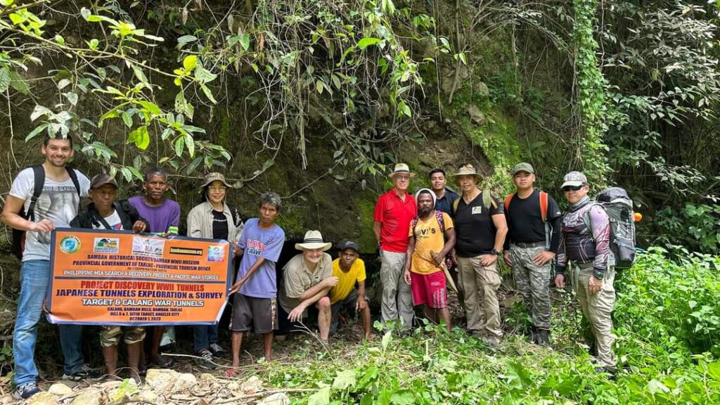
Our BHS Field Recon Team has been conducting for more than a decade, field survey of the Japanese WWII tunnels, many of them sealed during the Battle of Bamban Hills, or by soil erosion in the passage of time, or by human activity.
These tunnels are considered important WWII historical sites that should be preserved and protected as part of our historical heritage. BHS mission is to search for these tunnels, many sealed, and to open them for further study, survey and mapping, as well as updating our Data Base System for future use and reference.
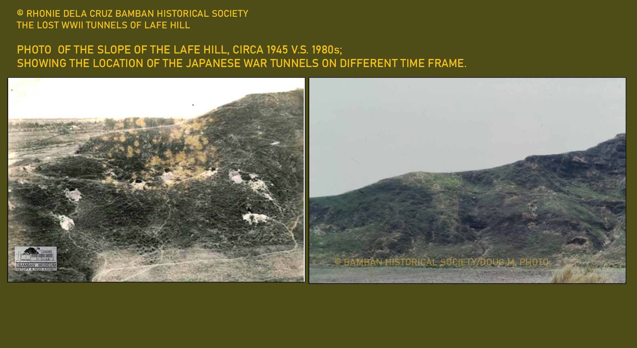
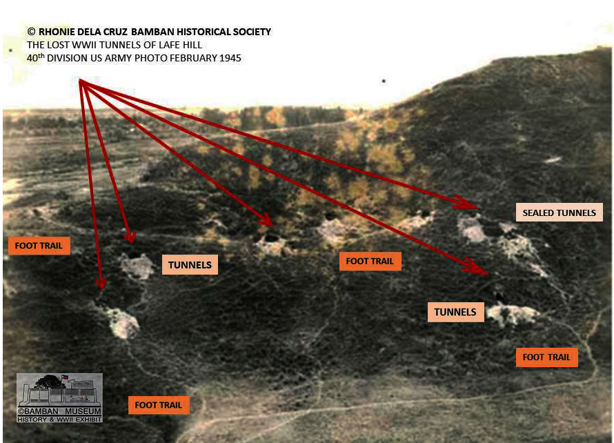
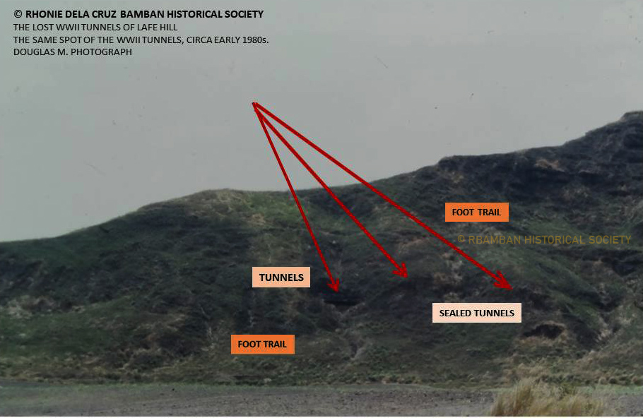
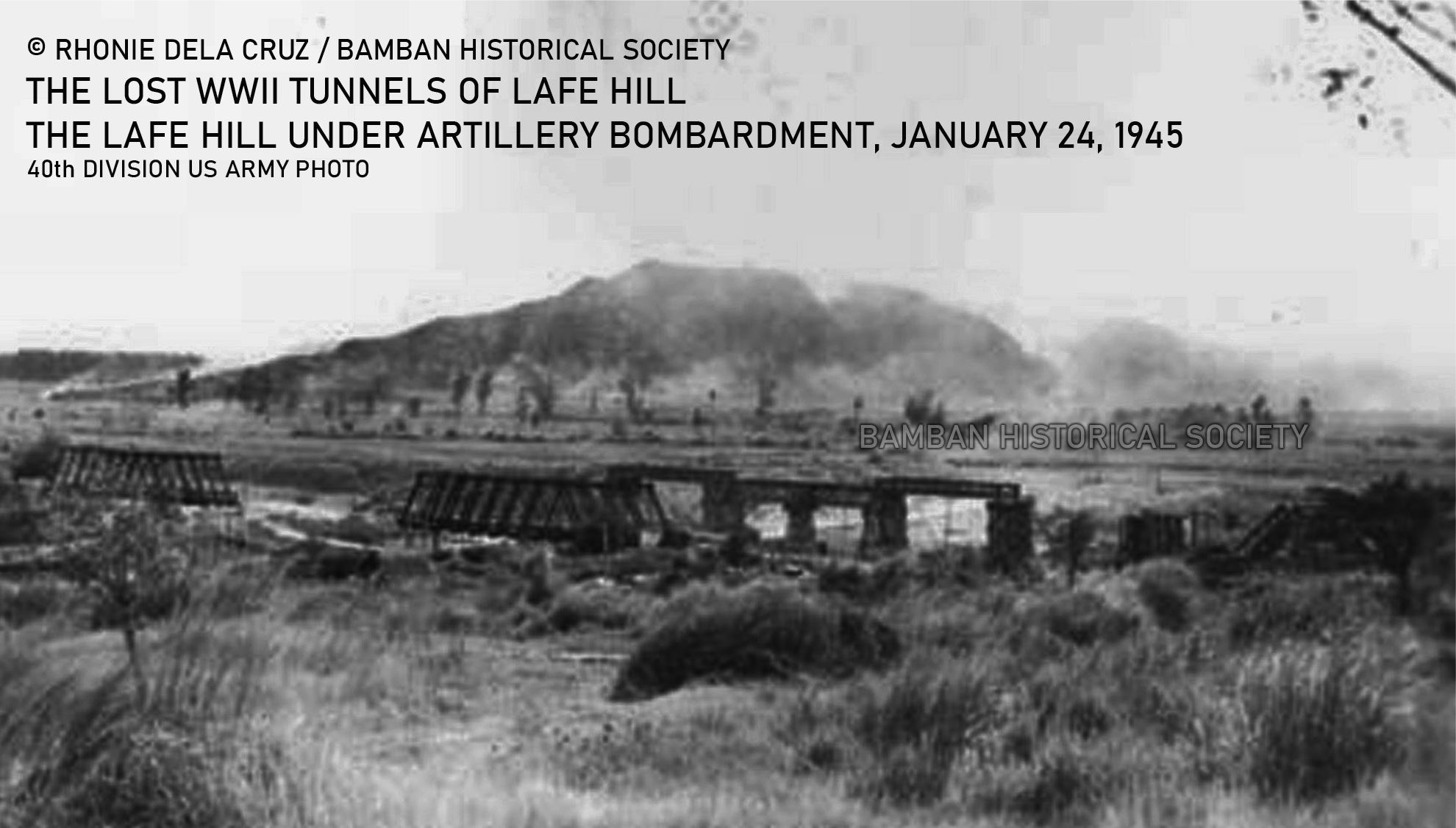
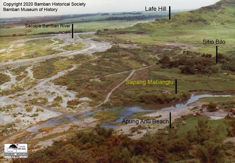
Citing the case of the Lafe, a photograph was taken by the 40th Division US Army in 1945 showing the effects of the artillery, tank, and aerial bombardments of the slope where many tunnels, counted more than 10 on specific area of the slope, and the image taken in early 1980 showing what remains of the tunnels.
In those years, that part of the Lafe Hill was owned by our uncle, Ramon Cauguiran, where on the plains were planted sugar cane. I used to go there frequently to help my uncle on his sugarcane plantation, and would go to the remaining open Japanese tunnels which I counted in the early 1980s as four.
We could make an observation between the two photographs taken in 1945 and 1980s on the Japanese tunnels, showing the extent of the passage of time without any preservation and protection programs on these historical sites.
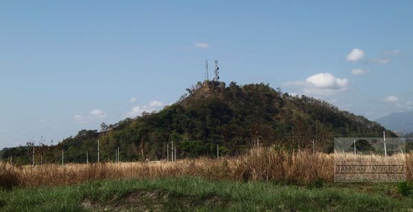
Past forward at present, the specific slope where the tunnels were located is now a mango tree area. We would like to conduct a field survey, cooperate with the new owner of the slope to check the condition of what remains of the tunnels of the Lafe Hill.
I would like to call the attention of our partners, Cris and Aries Dizon to conduct preliminary survey of that area and then we will go on our exploration in our attempt to document and preserve what is left of those tunnels that would tell part of the history of WWII.
PHOTOS:
(a) Photo comparison of the Japanese war tunnels of the Lafe Hill, circa 1945 and 1980s.
US NARA and Douglas M. photograph.
(b) The Japanese tunnels of Lafe Hill, circa 1945.
US NARA photo.
(c) The remains of the tunnels of Lafe Hill, circa early 1980s.
Douglas Montanino photograph.
(d) Lafe Hill, defended by the Okamoto Butai (132nd Airfield Bn stationed at nearby Mabalacat East Airfield in 1944), after artillery bombardments by the 40th Division.
US NARA photo.
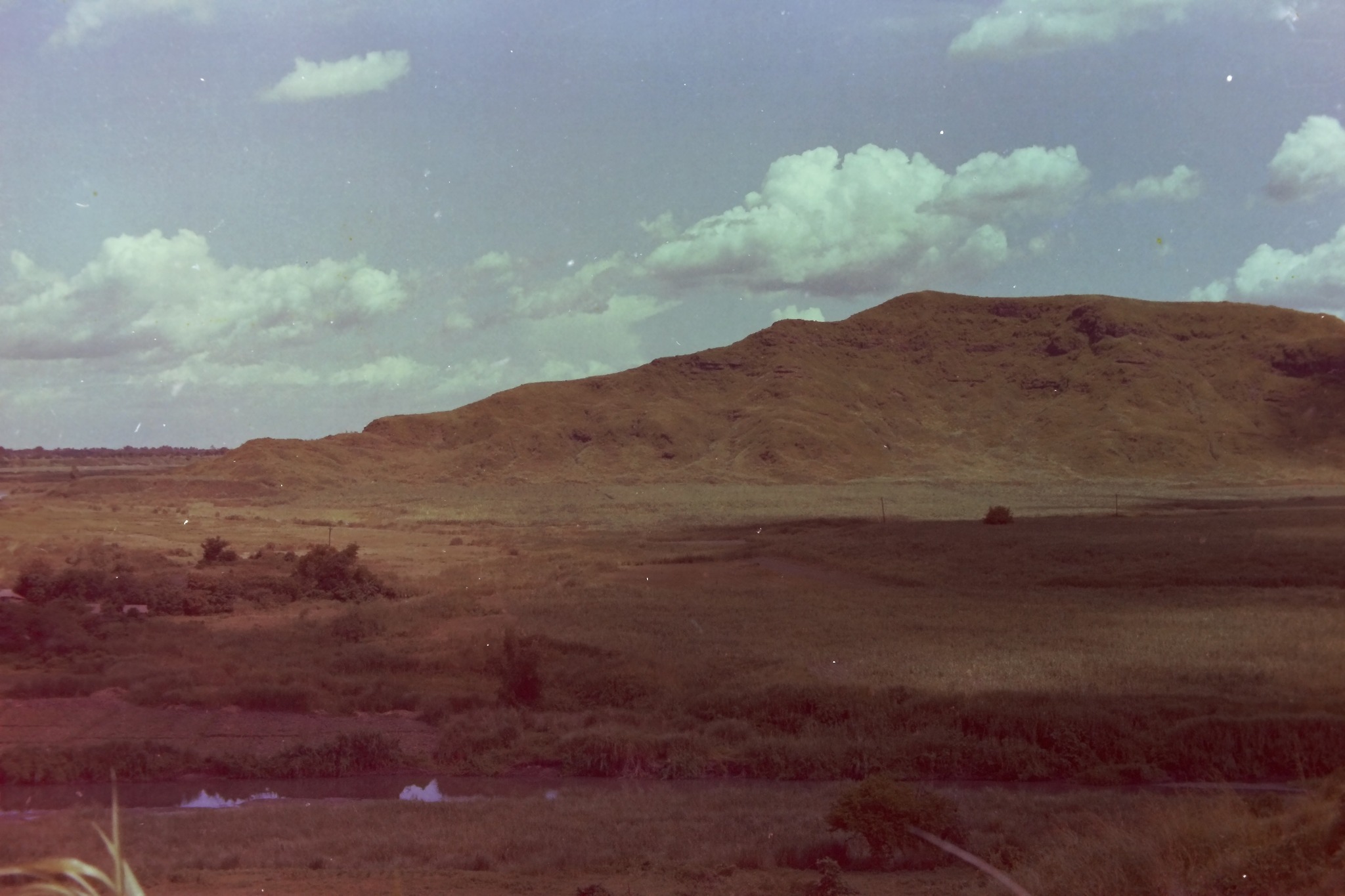
(e) Lafe Hill on the upper right, taken in late 1980s, showing the tunnels disappear from the vegetation.
David Metherell photo.
(f) The bare Lafe Hill, early 1980s, the effects of the massive aerial, artillery, and tank bombardments made the hill without any trees to grow. Sapang Mabanglu can be seen in the foreground.
Copyright Douglas Montanino photograph.
(g) The Lafe, circa 2022, showing the trees and vegetation, without trace of the Japanese war tunnels.
Rhonie Dela Cruz Photo.
