INVESTIGATING HISTORY:
THE JAPANESE WWII TUNNEL AT THE FORMER MABALACAT WEST AIRFIELD
*Note: original article was published on-line on October 4, 2020.
The hill-mass of the Babang Dapu used to be an old settlement that appeared on several maps during the Spanish colonial era, as well as during the American rule. Located on the edge of present Clark Field near the northern perimeter and the Clark North SCTEX road, the southern portion of the hill-mass is now a resettlement of Aytas and non-Indigenous People, where the gate of the Marcos Village lies nearby. To the north portion, a firing range is located, as well as the Mabalacat West Airfield memorial is established. This portion of the Babang Dapu used to be the edge of the former Japanese Mabalacat West airfield used extensively during 1944 and early January 1945, especially the Japanese Army and Navy special attack forces known as the Kamikaze.

MOJI CHIKANORI’S RECOLLECTION 門司親則の回想
As the Japanese Navy Special Attack was organized at the house of the Santos Family near the Mabalacat public market (present KFC restaurant), the first ceremony (water purification rite for the Kamikaze pilots) and briefing at an airfield was conducted by Vice-Admiral Ohnishi Takijiro on the edge of the Bamban riverbanks on October 20, 1944, just a few hundred meters away from the Babang Dapu. At the time, a temporary shelter (most likely a tent) was used by the Air Group 201 beyond the cliff, down the dry riverbank of the Bamban River, where final briefing is given to the Japanese navy pilots on special attack or conventional mission from the Mabalacat West airfield.
The tunnel, which is being called as “Seki Tunnel”, perhaps for tourism purposes, was not yet constructed during those period of the Special Attack, as narrated by the late Moji Chikanori who was an aide-de-camp of Vice-Admiral Ohnishi and always accompanied him during inspection and briefing of pilots on mission to Leyte and other parts of the Philippines from October 20, 1944 to the first week of January 1945. This author met Mr. Moji several times in his home in Oisho, Japan in 2000-2001 during historical research mission and gathered information based on interviews conducted.

CAPTAIN INAGAKI’S 52nd INDEPENDENT AIRFIELD COMPANY AT MABALACAT WEST AIRFIELD
マバラカット西飛行場の第52飛行場中隊司令官として日本軍稲垣大尉が就任。
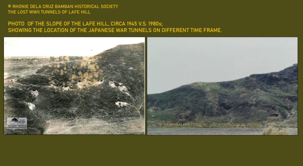
This is one of the very few existing Japanese WWII tunnels located near an airfield, aside from the one at Lilly Hill. During the war, many tunnels were constructed especially in late December 1944 and during the composition of the Japanese Army and Navy Kembu Group composite division of Clark-Bamban area around the airfields of Clark, where small hills are located like at Babang Dapu (Mabalacat West), Lilly Hill (near Clark No. 3), and Margot Hills (Margot Airfield); as well as those of the Dona Africa and Dolores (post WWII) Hill, where the Mabalacat East was located.
It was in early 1944 that most of the Clark satellite airfields were constructed from Mabalacat, Bamban, to Angeles, Margot, and further south in Porac. Each of the satellite airstrip was assigned an airfield battalion unit, or smaller one like airfield company. The main purpose of the airfield battalion was the maintenance, guard, and to some extent, logistics and defense, as outlined on the official Japanese military organization. Based on available records, mostly from the Kembu Group, the 52nd Independent Air Company, under Captain Inagaki, was in charge of the mission of providing defense and related tasks for Mabalacat West Airfield. Nearby the Clark North airfield in the vicinity of Lilly Hill, Major Higuchi of the 31stAirfield Battalion. All the airfield units were under the command of Lieutenant Colonel Seizuke Eguchi of the 10thAir Sector, 4th Air Army with headquarters located on the former barrio of old Dolores near Babang Dapu hill. In 1944, as the air operations at Clark Air Center begun active due to the prevalence of American air raids and with the implementation of the Sho-Go Operations at Leyte, the Mabalacat West became an important air base of several Japanese Army and Navy units including the famous Air Group 201, as well as other elements of fighters and bombers. A road was connected from the main runway of the airfield to the Babang Dapu, where tunnels were dug on the base of the solid rock hill that was very suitable for troops shelter, for hiding war supplies and perhaps, even for aircraft like those that appeared at nearby Lilly Hill.

It is my humble opinion based on historical facts, especially the testimony of the late Moji Chikanori, and the information on the Kembu Group records, that the tunnel located at Babang Dapu, Mabalacat West Airfield was not used by Lieutenant Yukio Seki of the Shikishima Special Attack at the time of the Kamikaze operations but rather was constructed during the Kembu Group mobilization which happened starting in the late December 1944. Otherwise, Moji Chikanori, acting as the secretary of then Vice-Admiral Ohnishi, could have seen the said tunnel, used by the navy pilots at the height of the special attack operations. Lieutenant Commander Moji’s book (At the Far End Between the Sky and the Sea – Reminiscences of the First Air Fleet Adjutant), a copy of which was given to me and recently translated in Japan, has explicit details of the visit of Moji at the hill and the pilots’ tent below the cliff and at the dry riverbed of the Bamban, which was near the tunnel. Both Moji’s books and English translation are available at the Bamban WWII Museum.

The important source of historical information on the Mabalacat West Airfield during the period of the Japanese Navy Kamikaze Special Attack Forces is this book authored by former Lieutenant Commander Moji Chikanori, At the Far End of the Sea – Reminiscences of the First Air Fleet Adjutant, which is actually his war memoirs in which he provided vivid historical narratives of the events of Vice-Admiral Onishi Takijiro’s several visits to the Japanese Navy’s Tokko Special Attack pilots at the edge of the Mabalacat West Airfield, below the cliff where the Bamban River used to flow. Nowhere in the book mentioned of any tunnel constructed at the time and used by the Kamikaze pilots including Lt. Yukie Seki and his Shikishima unit. A tent was used by the Kamikaze pilots as billet, while waiting for the order for sortie for Kamikaze missions. Recently, Kazuhiko Moji, the son of Chikanori Moji, provided the only English translation of the book and now available at the Bamban WWII Museum as part of the collection of the Bamban Center for Pacific War Studies.

BABANG DAPU WITH THE EGUCHI SHITAI’S FINAL DEFENSE OF CLARK FIELD; JANUARY 1945
トンネルとクラークフィールドでの日本兵の防御と戦闘、1945年1月。
With the landing of General MacArthur’s 6thArmy at Lingayen on January 9, 1945, the ground battle at Clark Field area had been anticipated by the Japanese forces at Clark. Preparations were made for the ground battle, and that Captain Inagaki’s 52nd Independent Airfield Company at Mabalacat West became part of the Kembu Group’s first line of defense with the Eguchi Shitai, numbering more than 4,600 troops. The whole stretch of the Babang Dapu, with the tunnel located north of the hill-mass, became a defensive position of Captain Inagaki’s unit.
On January 28, 1945, the American 37thDivision started the ground offensive at Clark Field. The 3rd Battalion, 129thInfantry led the attack on the Mabalacat West Airfield and that the tunnel, part of the defenses of Eguchi Shitai, took the brunt of the massive infantry and tank attacks. It had becoming clear then that the Japanese at Clark-Bamban area utilize the tunnel defense on the terrain to be able to survive the powerful American divisions tasked to eliminate the Kembu Group. Eguchi Shitai’s position, including those at the tunnels of Babang Dapu, collapsed and the unit retreated to the back of the present Clark parade ground for another defensive line.

THE TUNNEL OF CAPTAIN INAGAKI 稲垣船長のトンネル
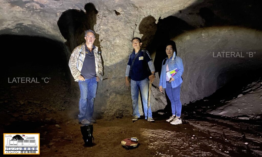
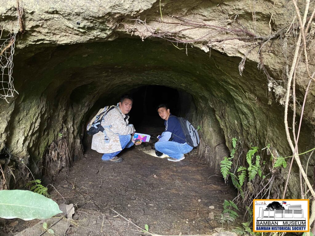
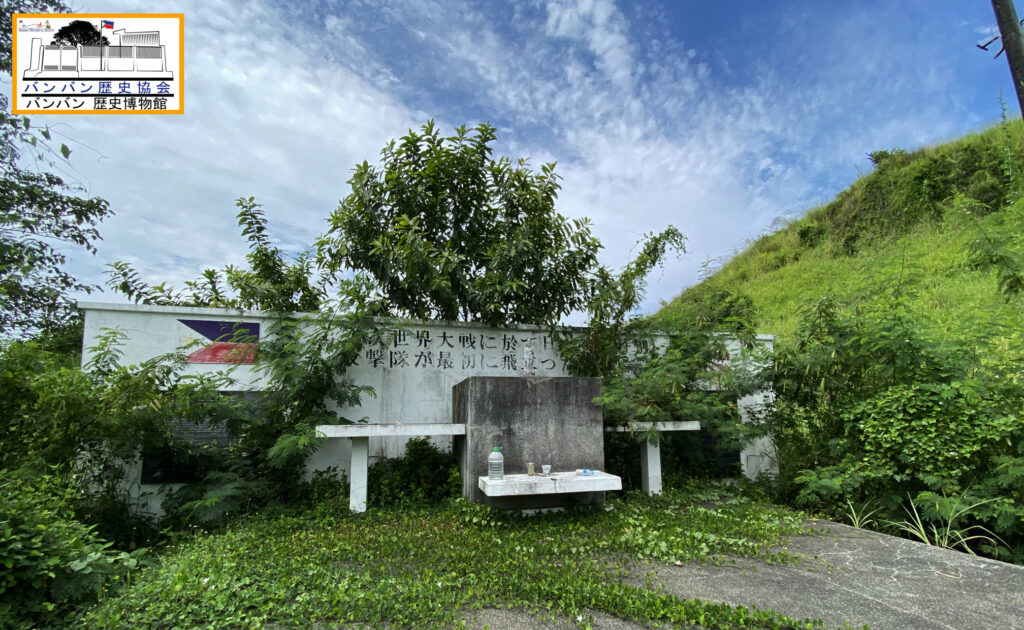
Seventy-five years since the end of WWII in the Philippines, and same goes to the battle at Clark Field, the tunnel at Babang Dapu, on the edge of Mabalacat West still exists. A CDC marker is placed near the entrance, calling it Seki tunnel. On my part, I call it more appropriately as Inagaki tunnel, in remembrance of the Japanese in command of the area at Babang Dapu-Mabalacat West airfield in late 1944 until January 1945 with the 52nd Independent Airfield Company assigned in the sector of the Eguchi Shitai. I had been to this tunnel several times, but I was not given the opportunity to conduct a comprehensive field survey and inspection, until lately, with the assistance of Roger Dela Cruz, was able to plan and initiate field recon.

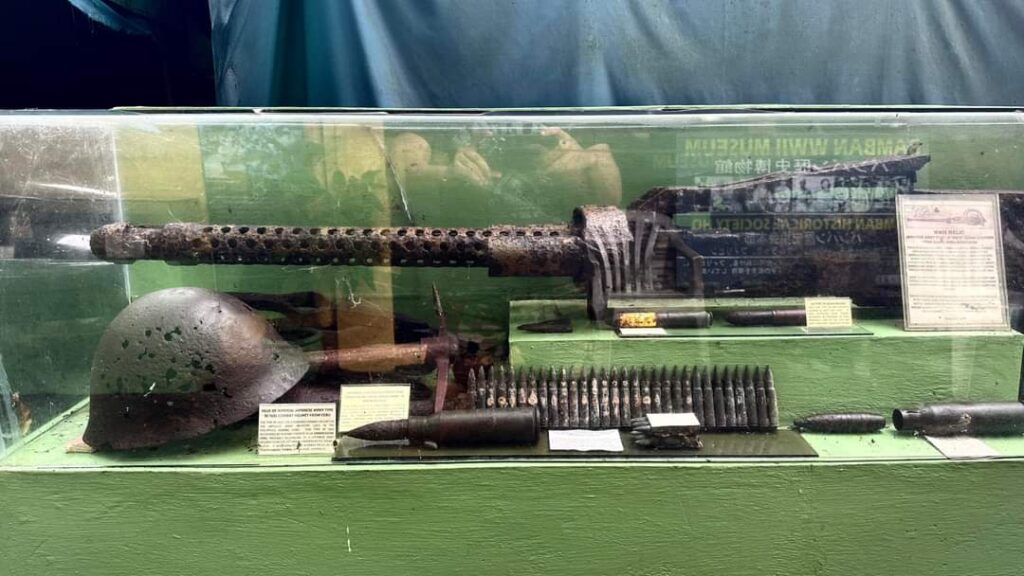
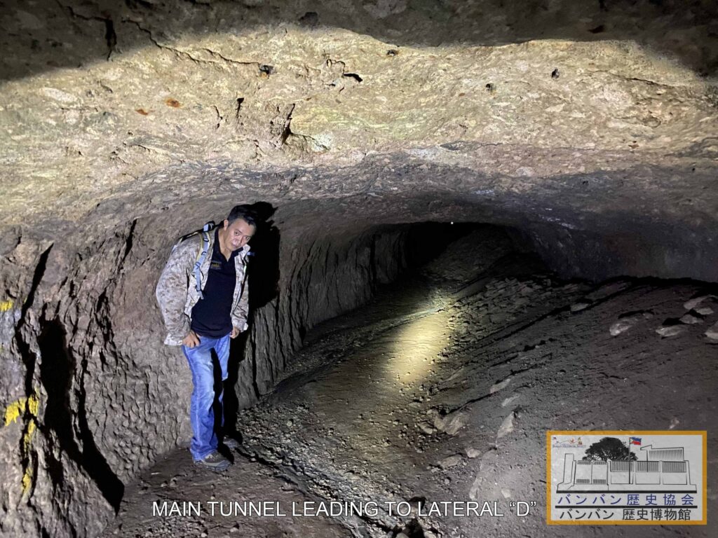
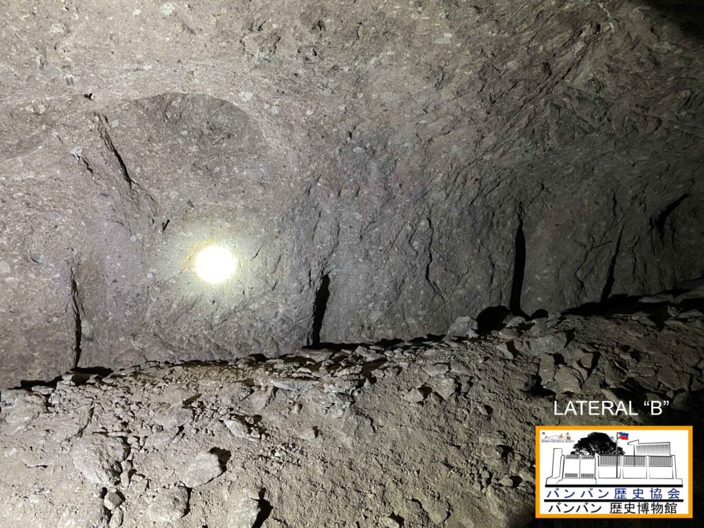
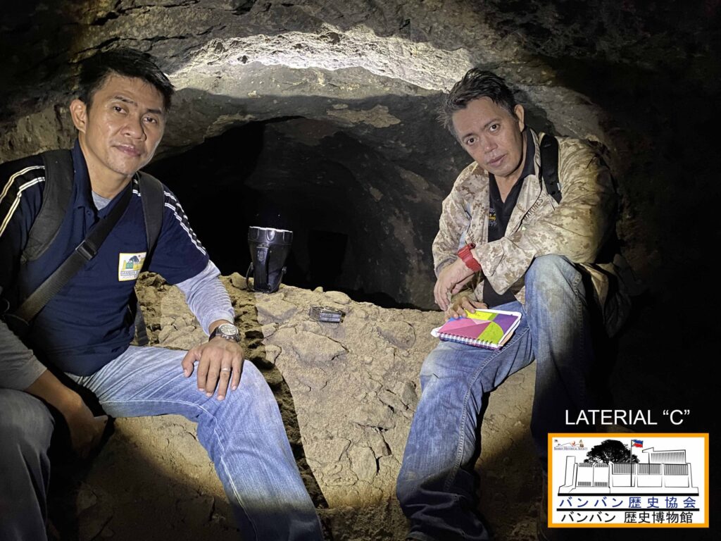
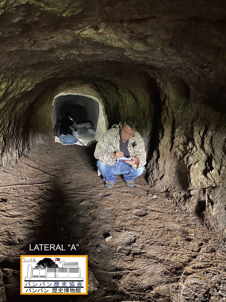
During actual exploration conducted on the morning of October 2, 2020, we were able to do measurement of the inside of the tunnels and its laterals. The tunnel has 3 laterals, with the left and right main tunnel routes and the main entrance. A combine length of the tunnel can reach an estimated total of more than 350 feet. Although, the inside of the tunnel and the laterals contain mounds of soil debris, evident of recent human activity, it may be deduced based on our observation that an average of about 3 meters wide and 2.5 meters in height can be concluded. In addition, we observed that there was massive black coloring on the surface of the tunnel and its laterals, indicating that massive flame throwers were used by the 129th Infantry during the battle to flush out the Japanese defenders holed inside. We were also able to do photo and video documentation of our exploration in order to make necessary historical and scientific study of this relic history of WWII.
PRESERVATION FOR WWII HISTORY 第二次世界大戦の歴史の保存
We hope that this tunnel will be preserved and allowed to be visited to gain knowledge and experience of the history of WWII in our area. At present, thick foliage around the Babang Dapu hill covers the vicinity due to the prevailing rainy season that it took us sometime to clear the entrance of the tunnel. There were reports that big snakes like python and Philippine cobra inhabited the inside of the tunnel but that were proven to be false. Otherwise, we can have the best adobo in our menu in the aftermath of our exploration.

It was cited in the US Army Military Bulletin that the tunnels of Bamban and Stotsenburg “represents the most extensive tunnel defense system ever fought in the Pacific outside Okinawa” during WWII. And the tunnel of Babang Dapu, used by the Inagaki Unit, is just one of the many tunnels of the Clark-Bamban area that give credit to that account. We hope that in our next Battlefield History Study, interested people can join us for exciting experience in our study of the war of our grandfathers and uncles.
Rhonie Dela Cruz ロニー・デラ・クルーズ
With Andrew Manabat, Buddy Carino and Hope Aquino
Bamban Historical Society/Bamban Museum of History
バンバン歴史協会 / バンバン第二次世界大戦博物館
CITATIONS
(1) Okada, Yasuji (Colonel, Chief of Staff of the Japanese Kembu Group). Japanese Monograph No. 9. “Outline of the Kembu Group Operation – Clark Sector, Record of the Philippine Operations Record of the Philippine Operation Vol. III Part 3”.
(2) Griswold, Oscar W. XIV Corps M1 Operation, “After Action Report Xiv Corps M1 Operation”. Headquarters of the XIV Corps. Office of the Commanding General, 29-July-1945.
(3) Chikanori, Moji (aide of Vice-Adm. Ohnishi). Interview by the author on Bamban Naval HQ. Oiso, Japan, June 16 and August 5, 2001.
PHOTOS
(a) Photo taken inside the tunnel, with Lateral B and C.
Rhonie Dela Cruz/Bamban Historical Society Photo.
(b) Comprehensive mapping and measurement of the tunnel used by the command of Captain Inagaki. Copyright Rhonie Dela Cruz, Bamban Historical Society/Bamban Museum of History.
(c) Members of the Shikishima-Tai of the Japanese Navy 1st Special Attack Corps, in formation taken on October 21, 1944. This photo was taken on the north side of the tunnel, which is now the same highway leading to SCTEX tollgate of the Clark North. The small hill, with the bamboos, is the Babang Dapu.
Photo by Naoki Koudachi.
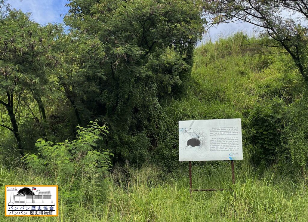
(d) Babang Dapu, with the west airfield marker and the tunnel marker.
Rhonie Dela Cruz/Bamban Historical Society Photo.
(e) Japanese map showing the Mabalacat West Airfield, connected to the Babang Dapu via a road network.
Source: Major Eguchi of the 10th Air Sector, 4th Air Army
(f) Moji Chikanori, secretary of Vice-Admiral Ohnishi of the 1st Air Fleet, whom I interviewed several times in his home in Oisho, Japan in 2000-2001, on the information of the tunnel at Babang Dapu.
Photo by Naoki Koudachi, Bamban Historical Society collection.
(g) Another sketch of the tunnel of Captain Inagaki, showing Lateral C and Lateral D.
Copyright Rhonie Dela Cruz, Bamban Historical Society/Bamban Museum of History.
(h) Aerial photograph of the Mabalacat West, including the Babang Dapu, with the site of the tunnel as indicated. Photo taken in November 1944 by the US Navy (USS Hornet CV12). US National Archives NARA.
(i) 9 photos taken during our field survey of the tunnel on October 2, 2020. Each photo is marked where it is taken inside the tunnel, the lateral identified.
Rhonie Dela Cruz/Bamban Historical Society Photo.
(j) The Mabalacat West Airfield Memorial Marker, now full of overgrown vegetation. Babang Dapu Hill is to the right.
Rhonie Dela Cruz/Bamban Historical Society Photo.