INVESTIGATING HISTORY
THE AMERICAN AERIAL BOMBINGS OF JAPANESE-HELD CLARK FIELD: DECEMBER 24, 1944
(1944年12月24日、アメリカの飛行機が日本軍のクラーク飛行場を爆撃した。)
In this Holiday Season, we are enjoying the cold evening of Christmas and the upcoming New Year.
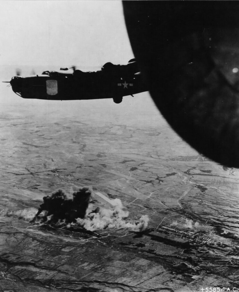
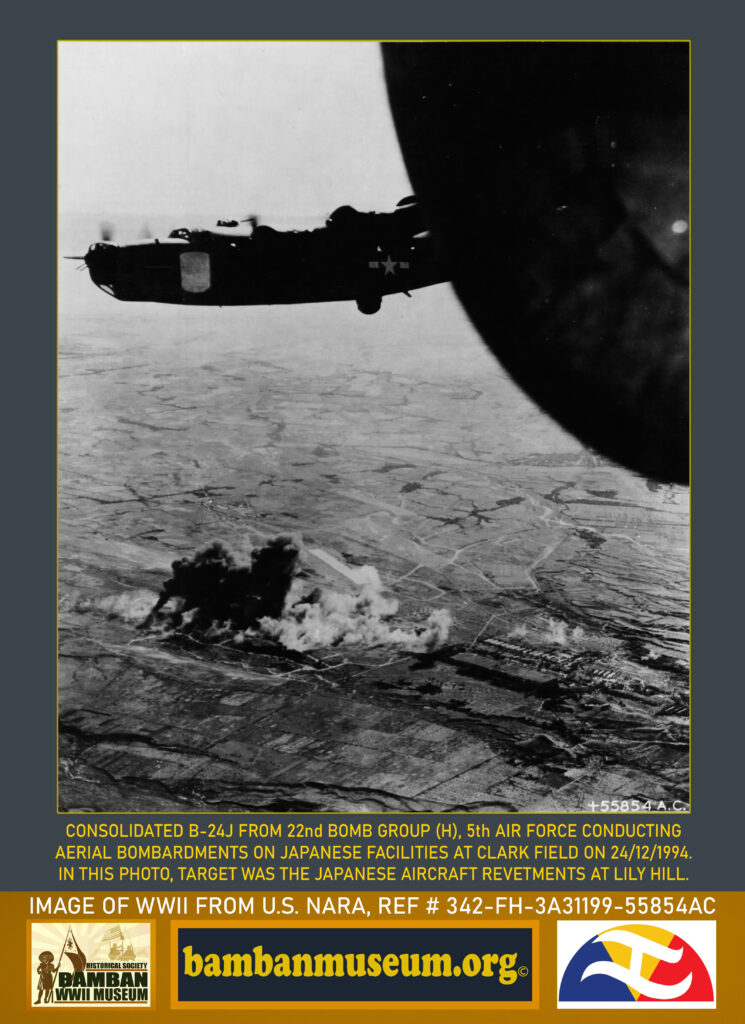
Going back in time, during WWII, in one of the many aerial bombardments conducted by the American navy carrier planes and Army Air Corps bombers at Clark Air Center, it was on Christmas Eve of 1944 when the Consolidated B24 from the 22nd Bomb Group (Heavy) did their job in dropping bombs on Japanese air assets and facilities.
This is an important aerial photograph taken during the air bombardments of Clark Field, the image showing the extent of the coverage of the Japanese air strips constructed, including the Dau Airfield which is visible in the image.
The prime target of the Consolidated B24s on this day, an particularly on the image taken as appearing are the aircraft revetments and taxiways in the vicinity of Clark No. 3 (Clark North), Clark No. 2 (concrete runway) and Clark No. 1 (longest air strip); with Lilly Hill, or the M201 Granite Hill as appearing on Japanese maps, as the center of air operations.
National Archives and Records Administration NARA provided details of the description of the image:
“Consolidated B24 (22nd Bomb Group) and North American B-25 and Douglas A-20s of the U.S. Army 13th, 5th and 7th Air Forces attack Japanese-held Clark Field on Luzon and other aerodromes in the Philippines in cooperation with the ground invasion. the American airmen shot down 104 Japanese planes and destroyed 252 on the ground. This is a view of one of the attacks on Clark Field.”
With then upcoming landing at Lingayen and ground operations for the invasion of Luzon by the Americans with General MacArthur, it was imperative for the American Air Forces to conduct massive air operations and neutralize Japanese air capability and destroy their air assets for the Liberation of Luzon.
On the identification of the Japanese airfields at Clark and nearby Dau and Angeles, several maps were used including Japanese map made by Fumio Kawasaki, who was a pilot from the 95th Sentai, 5th Air Brigade (later transferred to 4th Air Brigade at Clark Margot Air Field in November 1944).
The photograph of the bombing of Clark Field encompasses a panoramic view of all of the Japanese air strips, Dau and parts of Angeles, thereby for the study of WWII History in the area, this identification
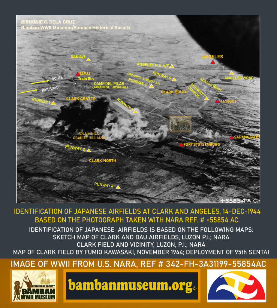
photograph was made.
Rhonie Dela Cruz
Historian
Bamban WWII Museum
Bamban Historical Society

