Investigating History:
THE BAMBAN CATHOLIC CEMETERY BASED ON SPANISH-ERA MAP CIRCA 1882
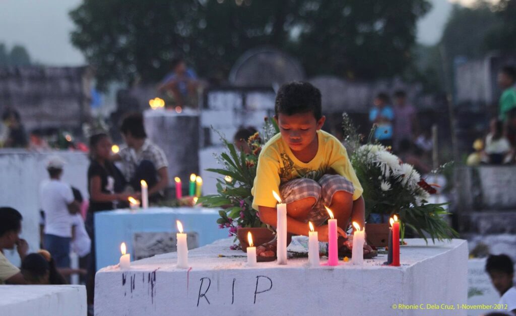
For some, it is All Hallows’ Eve or famously known as Halloween; the evening before the All Saints’ Day (November 1). It is declared as a Special Non-working Holiday, to give Catholics time to visit the beloved departed in their families until the following day. Public Catholic cemeteries in the country are being visited by the people and pay respect and remember to their loved ones interred.
Rhonie Dela Cruz Photo.
Here in my town of Bamban (Tarlac), our Public Cemetery (Catholic Cemetery) had existed since 1800s, since or town was an old settlement and one of the oldest towns of our Tarlac Province, having registered by the Spanish colonial regime and Church’ Augustinian Recollects missionaries in 1710. Prior to this year, it was believed that our town was settled originally by the Aetas, who ruled with a political structure, held by Juanico (Christianized name of the Aeta ruler of Bamban), son of Arap, on what is now the present poblacion; this was the historical set-up of our pre-colonial history.
US NARA, courtesy of David Metherell.
Nearing the turn of the century, Bamban was in the progress of development with the construction of the railroad line starting in 1882; the Manila-Dagupan stretching for a 195 kilometers stretch from Manila to Dagupan and passing the provinces of Bulacan, Pampang, Tarlac and Pangasinan. After a 10-year period of construction, it was opened to traffic on November 24, 1892, where Bamban had her own train station consisting of a 2-storey stone building. With this development of the train transportation, Bamban became part of the commercial centers in Central Luzon, where produce and people utilize the train transportation for logistics and mobility.
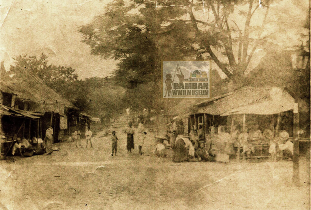
on the right side of the image.
Bamban Historical Society Collection.
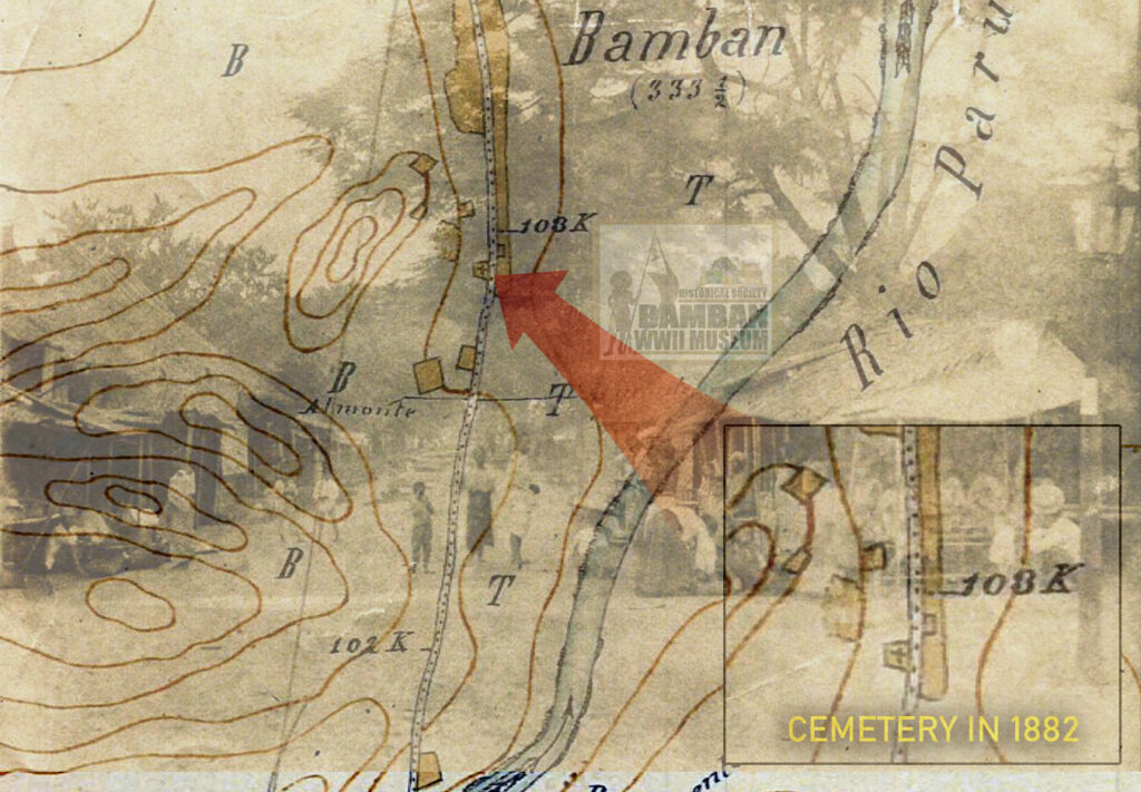
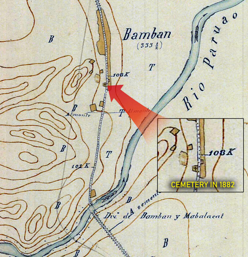
At the same time, a map was prepared by Juan Alvarez Arenas, called the Seccion de Filipinas De Manila A Tarlac (Section of the Philippines From Manila to Tarlac), where the Tarlac Province and in particular, Bamban, was part of the Sheet No. 6. The map was prepared, based on the descriptive drawing of the road, villages and topography, prior to the opening of the Manila-Dagupan Railroad Line in November 1892, since the railroad line is not yet visible on the map sketch.
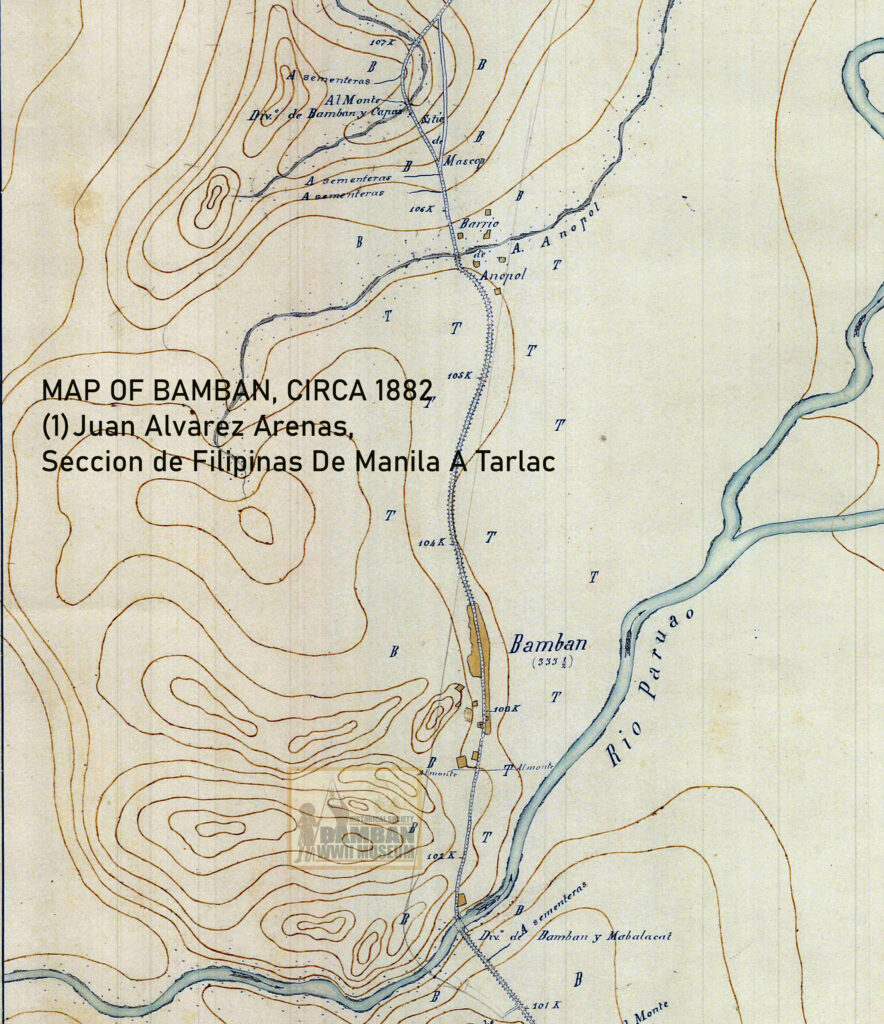
US NARA, courtesy of David Metherell.
The section for Bamban covered the boundary with the town of Mabalacat , (Div. de Bamban y Mabalacat) on the southern edge of the riverbanks of the Paruao, on what is now Dungan (Lalam Tete), Barangay Tabun. This also served the boundary between the provinces of Tarlac and Pampanga, since the birth of our province in 1874. To the north, the boundary (Div. de Bamban y Capas) was identified in the old sitio of Mascup, north of the Barrio de Anupol (Anupul). More than 18 years since the birth of the Tarlac Province, the town of Bamban became part of the transport development, where rice and sugarcane was produced in abundance, much like typical agricultural produce of most towns in Central Luzon especially in the provinces of Pampanga and Tarlac.
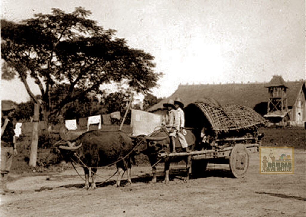
In the heart of the Poblacion, near the Augustinian Recollects church, marked or outlined enclosure with a Christian cross drawn inside in black; typical of the Spanish topographic maps in that era of 19th century which is identified to be a cemetery (Cementerio). The Juan Alvares Arenas map with Sheet No. 6, that covers the town of Bamban and Capas, provides topographic elements with the cemetery in Bamban in 1882, established beside the Calle Real; the principal dirt road at the time of the Spanish colonial period, coming from the south in Pampanga to the north in Tarlac. In 1887, the local population of the town was only 1,810, and by 1894, population in the town center (Poblacion) was only 1,580 while that of the whole town that covered the barrios of Anupul, Pacalcal (Virgen Delos Remedios), Bangcu and Culubasa was 3,202 souls.
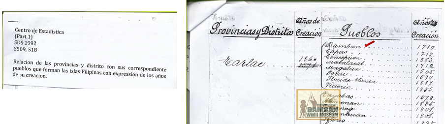
Philippine National Archives.
Thus, our very own Bamban Catholic Cemetery had existed already in the Spanish colonial era, since the 19th Century, and became mute witness in our History, where prominent and ordinary people of the town were buried in the passage of time and in the epoch of our Local History line in the time of the Juan Alarez Arenas map circa 1882 through the Philippine-American War, WWII and post-WWII including the eruption of Mt. Pinatubo in 1992.
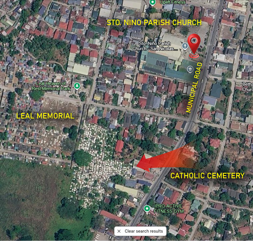
Google Earth image.
On this All Saints Day, when we visited the graves of our beloved departed family members, let us be reminded that to those, who, like my Cauguiran-Dayrit-Dela Cruz Family, originally from this town, our ancestors where buried at the old Catholic Cemetery. Our town’s founding families are buried there, somewhere, many forgotten and perhaps, their graves where already lost or forgotten, especially those who died in the 1800s through the early 1900s and even after WWII.
We may never know our all ancestors that were buried in this old Catholic Cemetery, except perhaps our grandfathers and uncles, but let us just remember them and pray for their eternal repose of souls.
© 2026 Rhonie C. Dela Cruz
Bamban WWII Museum/Historical Society
PGT – Tarlac Provincial Tourism Office
Citation:
(1) Juan Alvarez Arenas, Seccion de Filipinas De Manila A Tarlac – 6.Hoja, 7. Hoja 1882, maps, US National Archives, Maryland, Bamban Historical Society Collection, Bamban Museum. Courtesy of David Metherell.
(2) Historical Data Papers for Bamban, Philippine National Library, 1950-195.
(3) Arturo G. Corpuz, The Colonial Iron Horse: Railroads and Regional Development in the Philippines, 1875-1935.
(4) Direccion General de Administracion Civil, Num 1 Centro de Estadistico, Nomenclator General de Filipinas – Provincia de Tarlac, Pueblo de Bamban 1894, translated by Charlene Manese, Philippine National Archives.