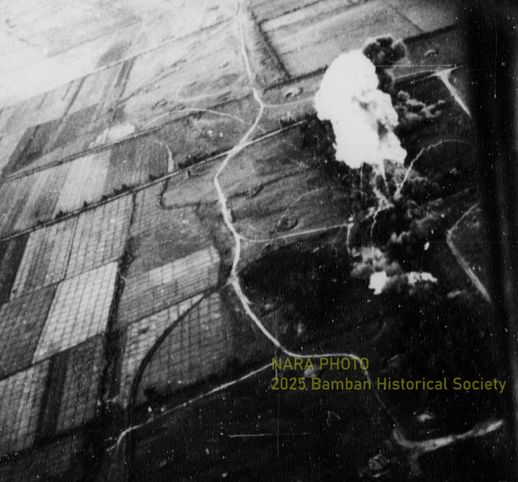
NARA Photos.
Investigating History: The Japanese WWII Airfields
THE MABALACAT EAST AIRFIELD, NOVEMBER 6, 1944 AND
NOVEMBER 1, 2025
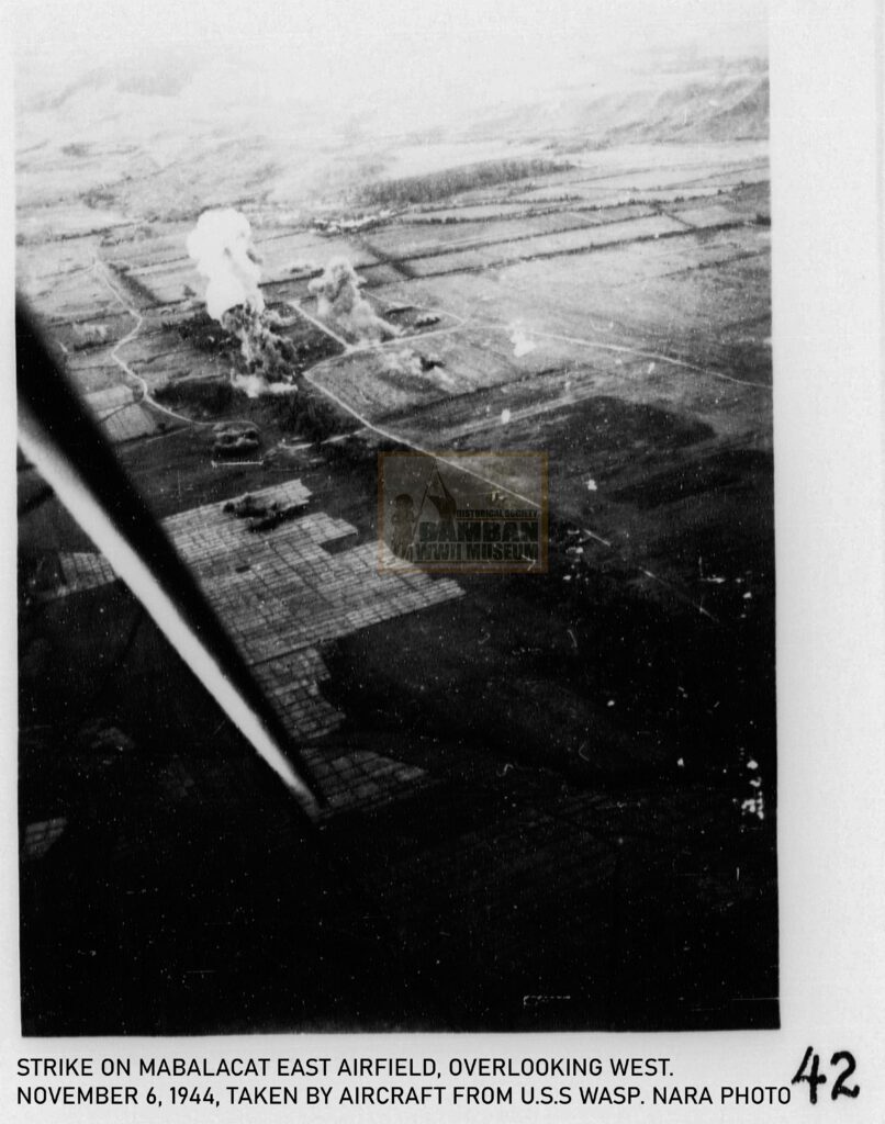
Photos shows the Mabalacat East Airfield in aerial view taken by aircraft (probably F6F Grumman) from U.S.S Wasp that conducted massive air attacks and fighter sweeps on November 6, 1944. Two images were taken during the fighter sweeps, one overlooking east and the other one overlooking west.
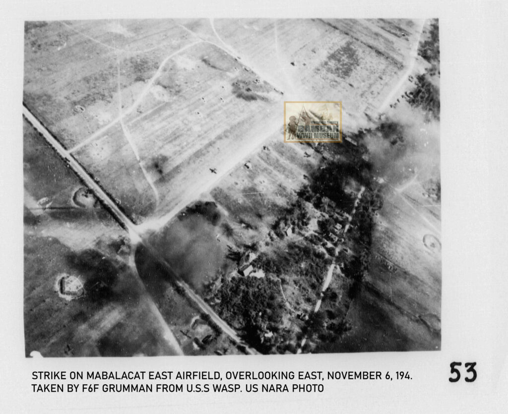
Both photos show the facilities of the air strip of the Mabalacat East, although only the auxiliary runway located near the edge of the barrio. The other main strip is located on the left of the auxiliary air strip. Revetments, taxiways, anti-aircraft guns and the village of Cacutud are identified in both the two images taken, aside from the clouds rising because of the bombings and the strafing of the fighter sweeps undertaken by the aircraft from the U.S.S. Wasp: 13 SB2C -3 Curtiss SB2C Helldiver from VB-11 Squadron, 21 F6F Grumman Hellcat from VF-14, and 15 Grumman TBF/TBM Avenger torpedo bombers.
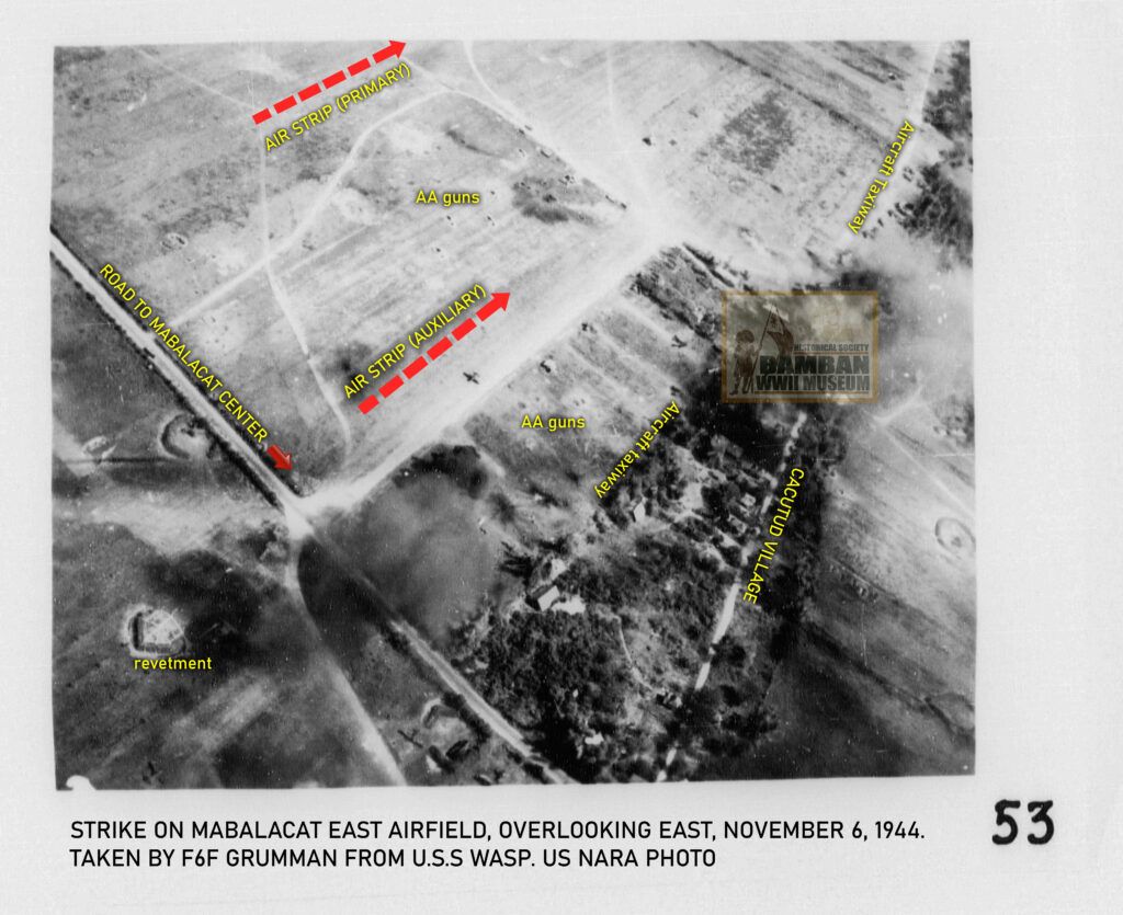
Mabalacat East Airfield was the target for this day by the U.S.S. Wasp, due to its high concentration of aircraft from both the Imperial Japanese Army and Navy Air Services. Aside from being the base for the Kamikaze Special Attack, the airfield was also utilized by several naval air groups for tactical air operations and air interceptions.
By this time, the Japanese airfield battalion had already established many anti-aircraft gun batteries surrounding the Mabalacat East Airfield with moderate to intense fire on American marauding aircraft from U.S.S Wasp.
Many of the bombings and staffing / fighter sweeps had attacked parked aircraft on taxiways and dispersal areas in the fields, while facilities, buildings, barracks, and even ammunition dumps were directly hit by the bombs. Fires were observed at the dispersal areas, hitting parked aircraft and dumps.
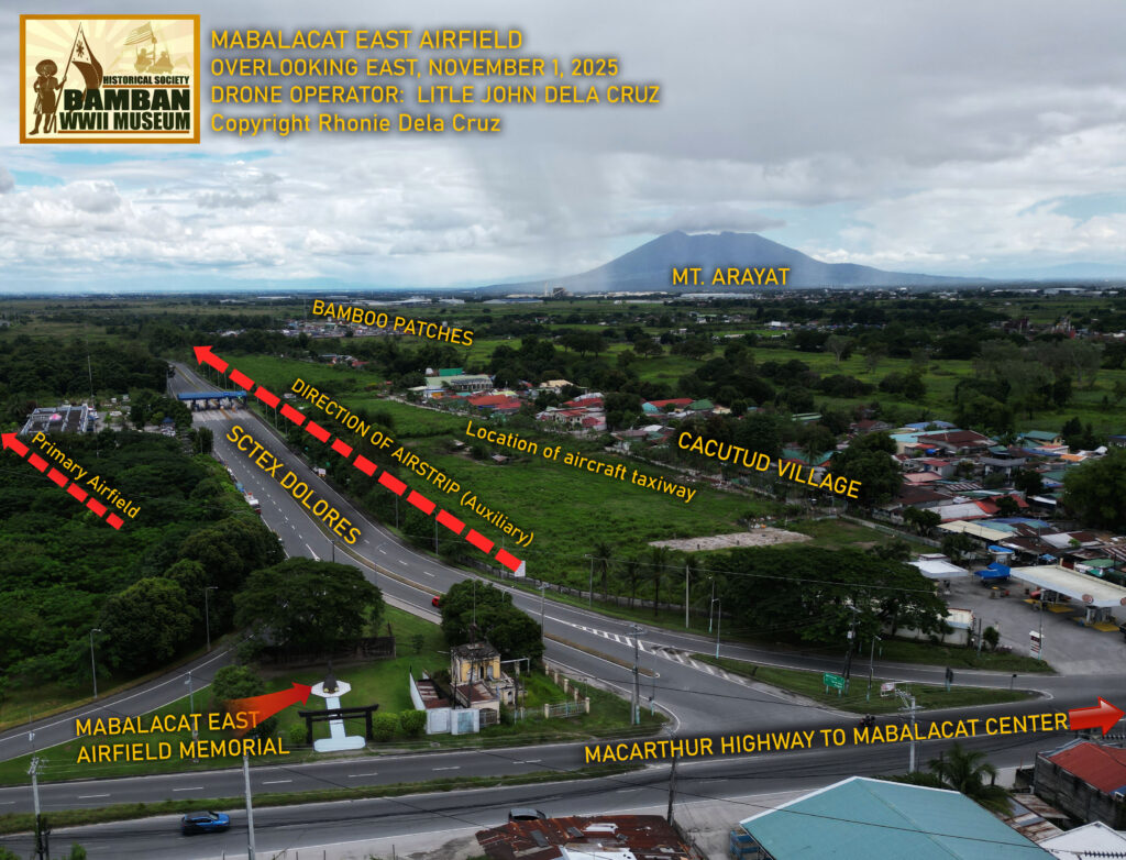
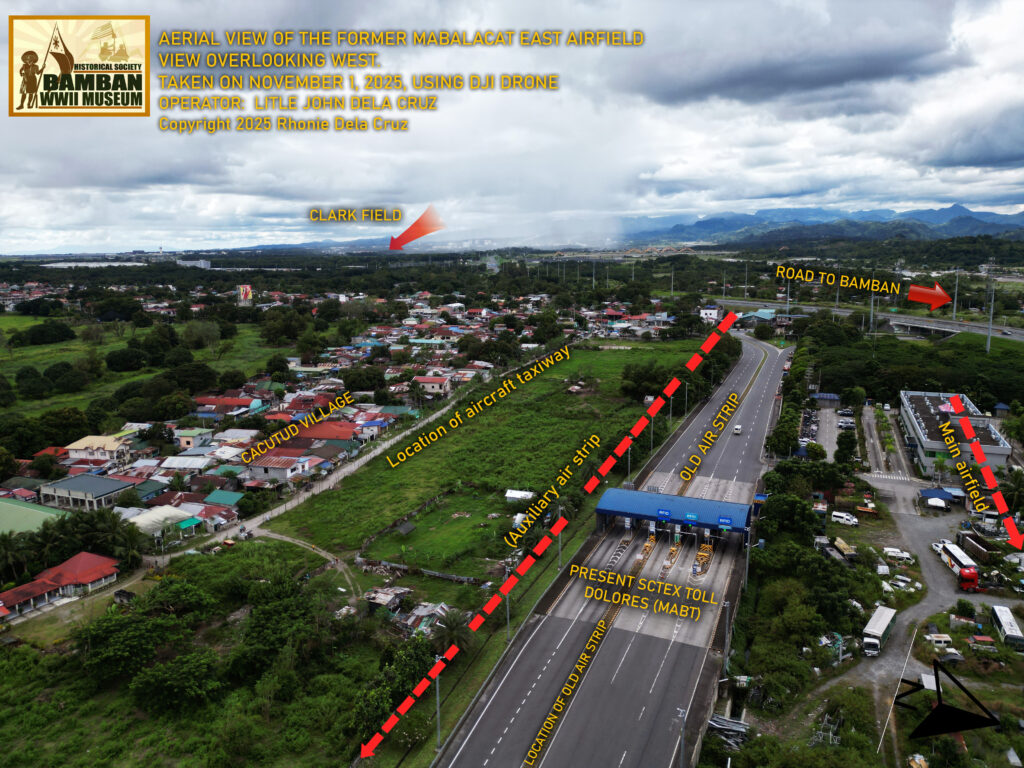
These photographs of the Mabalacat East Airfield were taken by the aircraft from the U.S.S Wasp during the air attacks on November 6,1944. 81 years later, last November 1, 2025, our Field Recon Team from Bamban WWII Museum conducted aerial survey of the Mabalacat East Airfield with the use of DJI drone, operated by my son Little John.
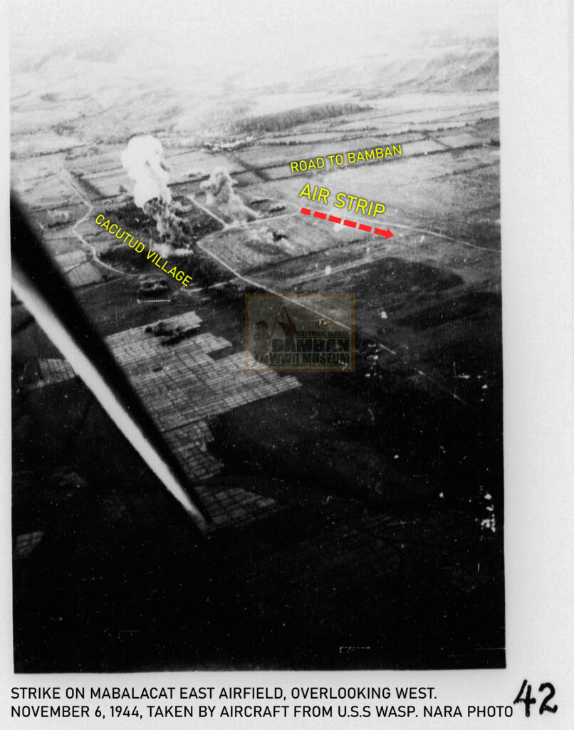
The two images, both taken overlooking east and west, comparable to the images taken on November 6, 1944, are good comparative photographs of historical importance and study. In the passage of time, with the town’s economic progress, the Mabalacat East Airfield to this day, still look semblance of the old airfield used by the Japanese Kamikaze as main airfield of operation, with the distinctive location of the Cacutud village and the auxiliary air strip.
Citation:
(1) AFTER-ACTION REPORTS from USS Wasp, Report Nos. 128; 125; 126.
Photographs:
(1) The two aerial photographs of the Mabalacat East Airfields were taken by USS Wasp aircraft, sources corresponding to AFTER-ACTION REPORTS from USS Wasp, Report Nos. 128; 125; 126.
(2) The drone aerial photographs were taken by Bamban WWII Museum Field Recon Team, led by Little John Dela Cruz.
Copyright 2025 Rhonie Dela Cruz
Bamban Historical Society
Bamban WWII Museum
Center for Pacific War Studies
Provincial Government of Tarlac –
Tarlac Provincial Tourism Office

